
Waterfalls
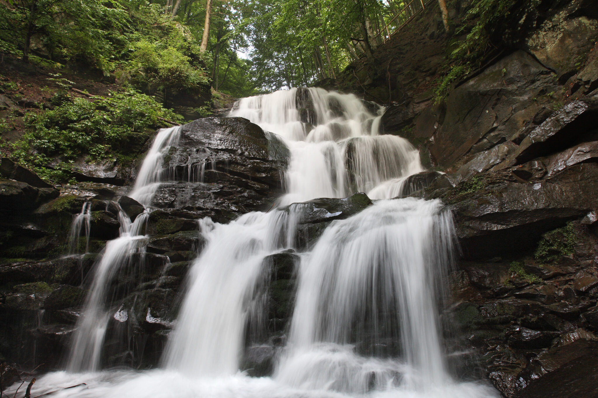
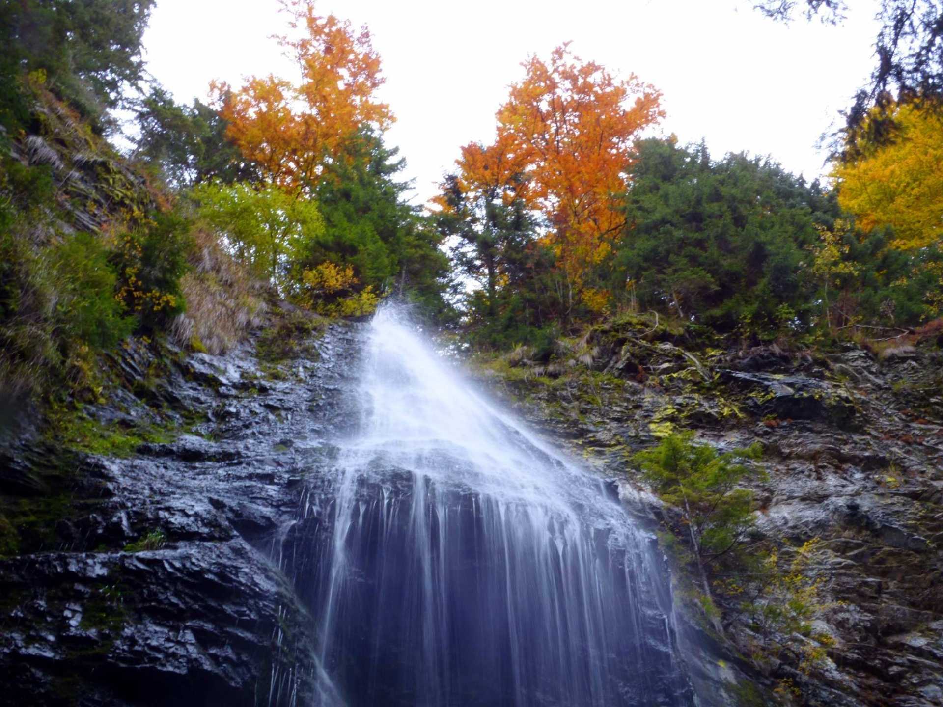
Hiss
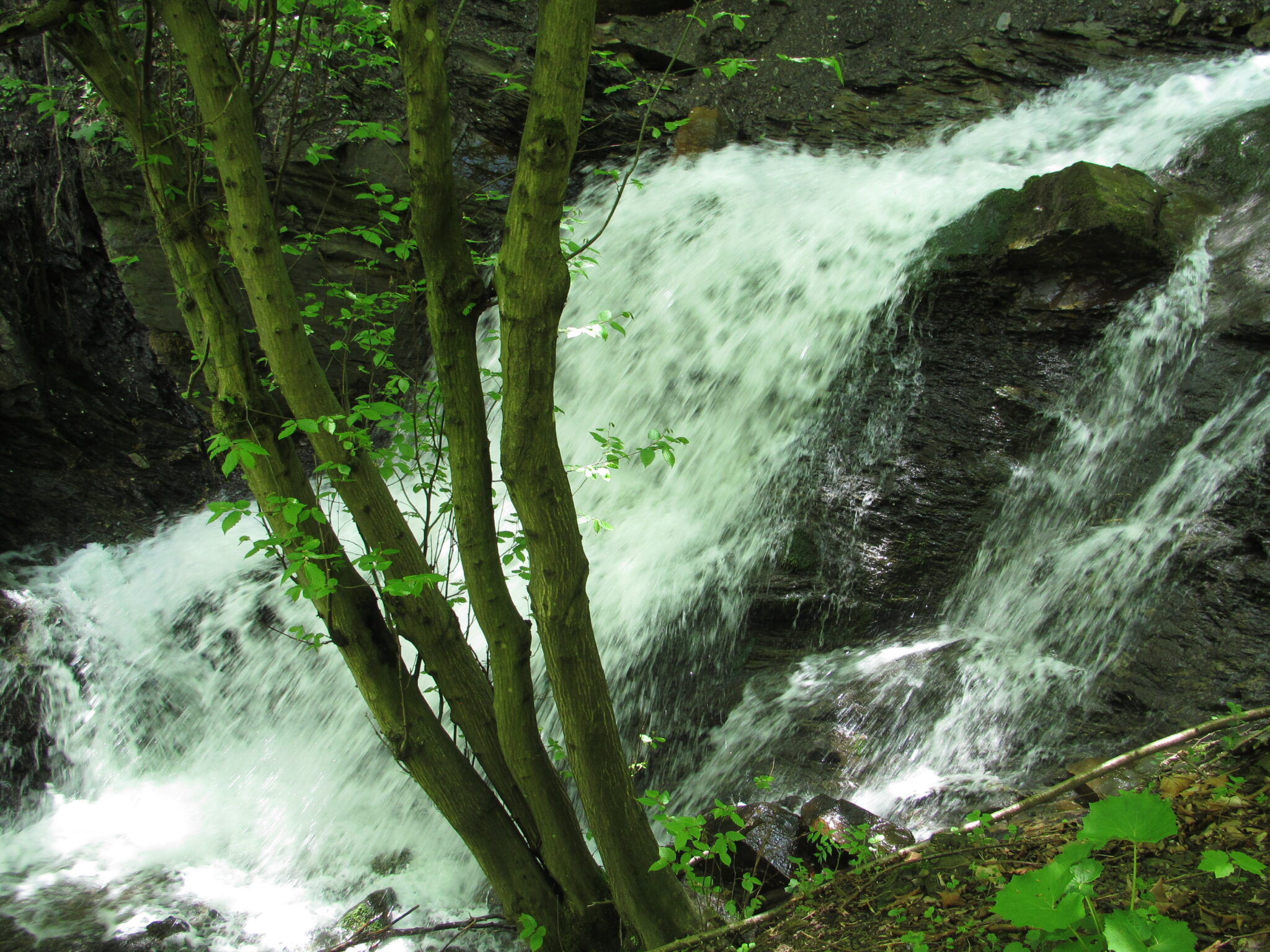
The legendary 14 m high waterfall is a hydrological natural monument of local importance. One of the seven natural wonders of Ukraine is located within the Khust district of the region on the northern slopes of the Borzhava valley, in the gorge of the Pylypets River, where Mount Gimba rises. Scientists believe that the waterfall was created at a place where Paleogene sandstones were exposed.
You can admire the most majestic waterfall in the region in any season, because in winter the river does not freeze completely, and in autumn it is fascinating with colours. But the best time to contemplate the picturesque nature and meet the Shipot is in spring, when snow melts from the mountains and slopes and fills the reservoir. You can approach the natural attraction from both the top and the bottom, and the beauty will be attractive from everywhere.
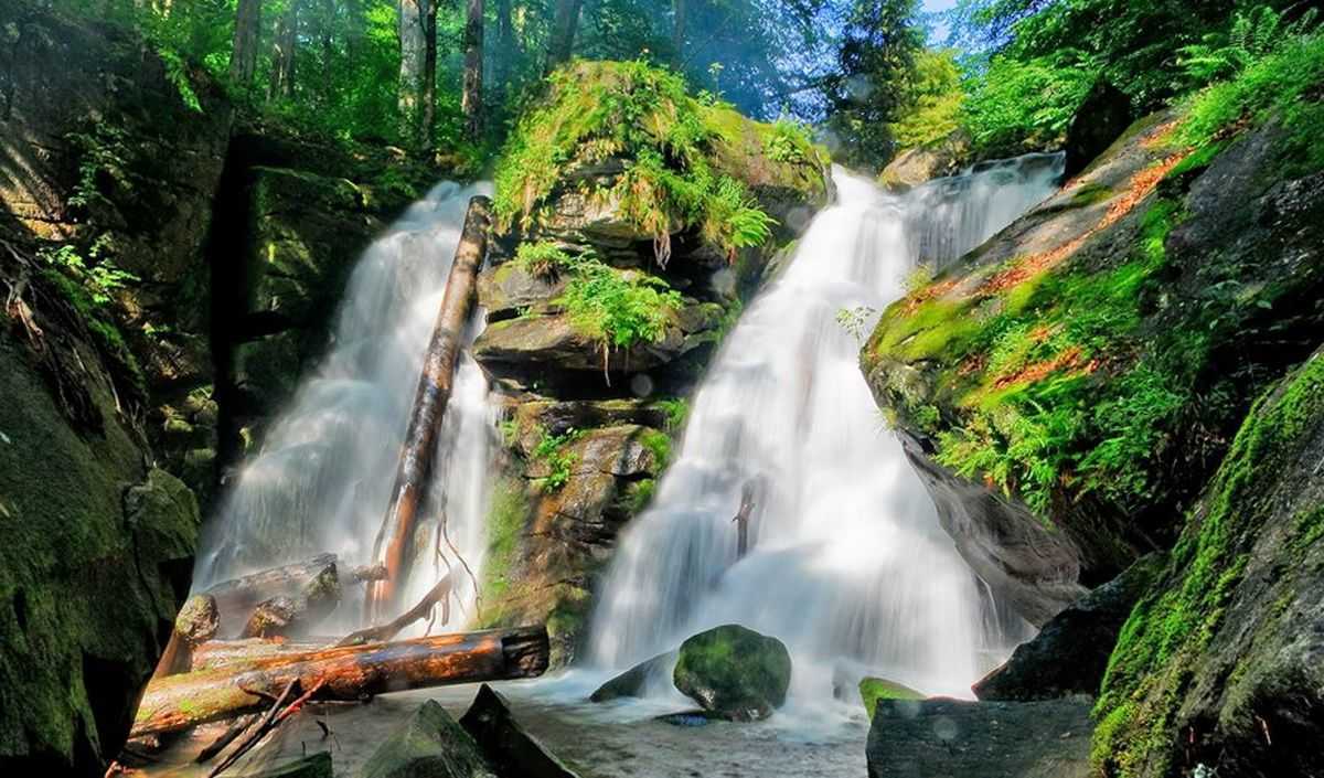
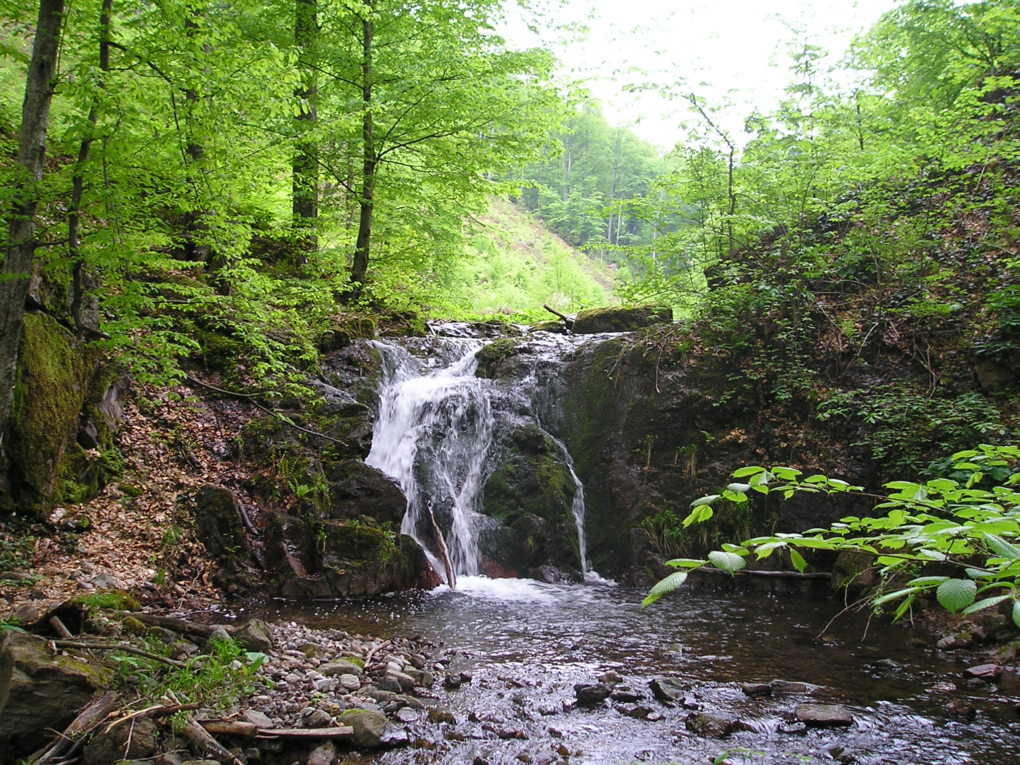
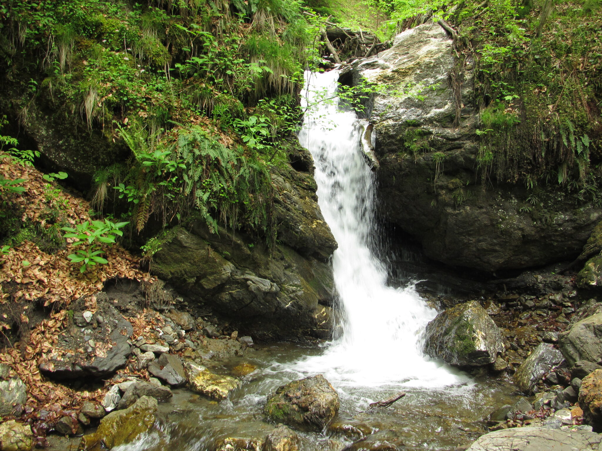
Vojvodin
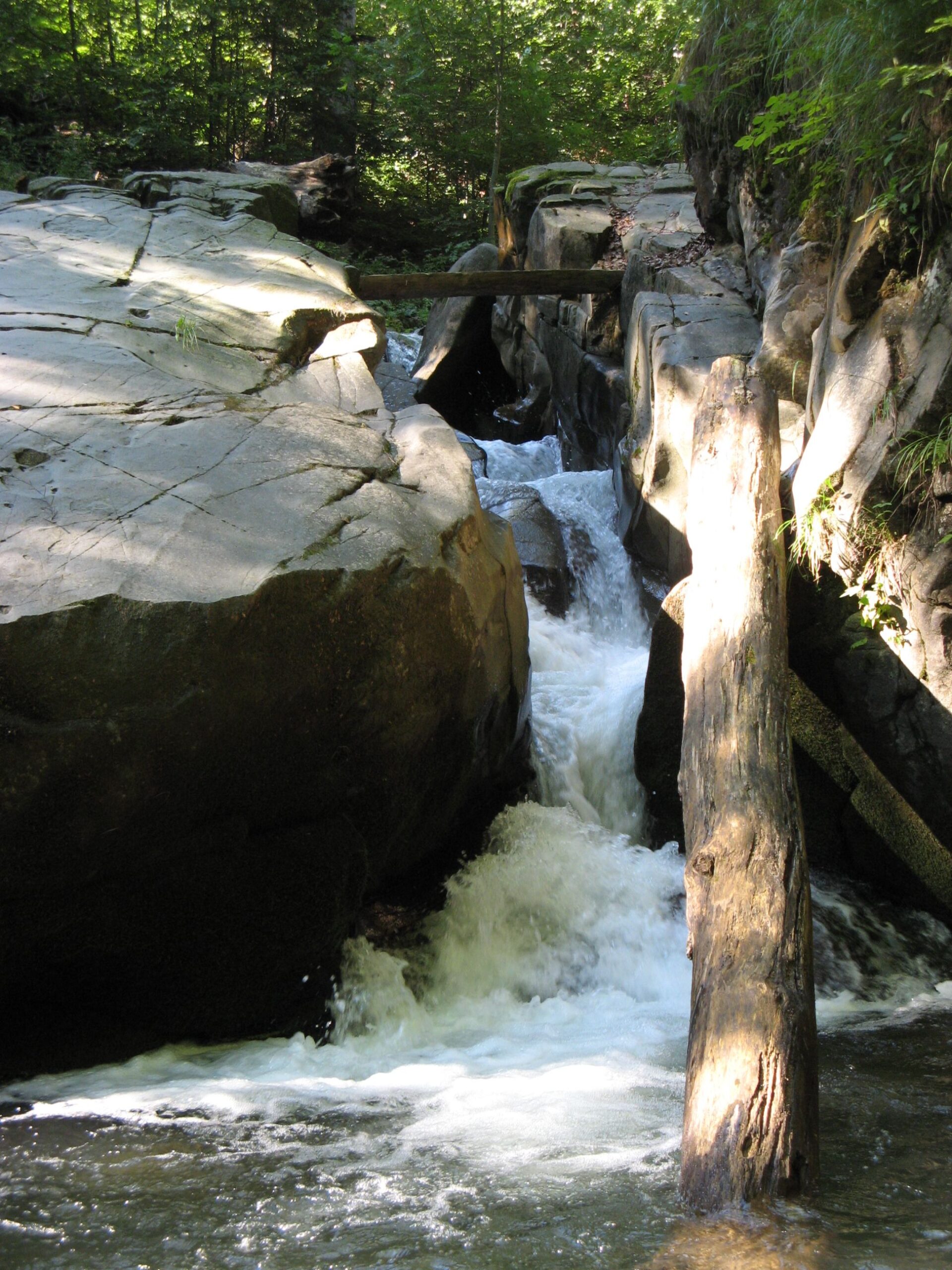
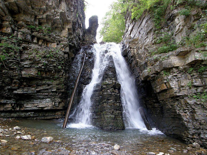
The natural wonder is located on the southern slopes of the Polonyna Runa mountain range, within the Sokolovi Sklyky (Falcon Rocks), an ornithological reserve of national importance, near the village of Turya Polyana in Uzhhorod district. The water falls in two separate streams, with a total cascade height of up to 24 metres, but the main cascade is 5-6 metres. Currently, only one of the two streams remains, unfortunately, the smaller one is blocked with wooden blocks and stones. It is believed that the waterfall was formed as a result of an earthquake, during which a crack in the rock appeared across a deep, narrow valley. The Voyevodyn Stream originates in Polonyna Runa, flows through a deep gorge and empties into the Shipot River.
The name of the waterfall is an interesting idea, derived from the word "howl", like water howling as it quickly falls down a mountain river.
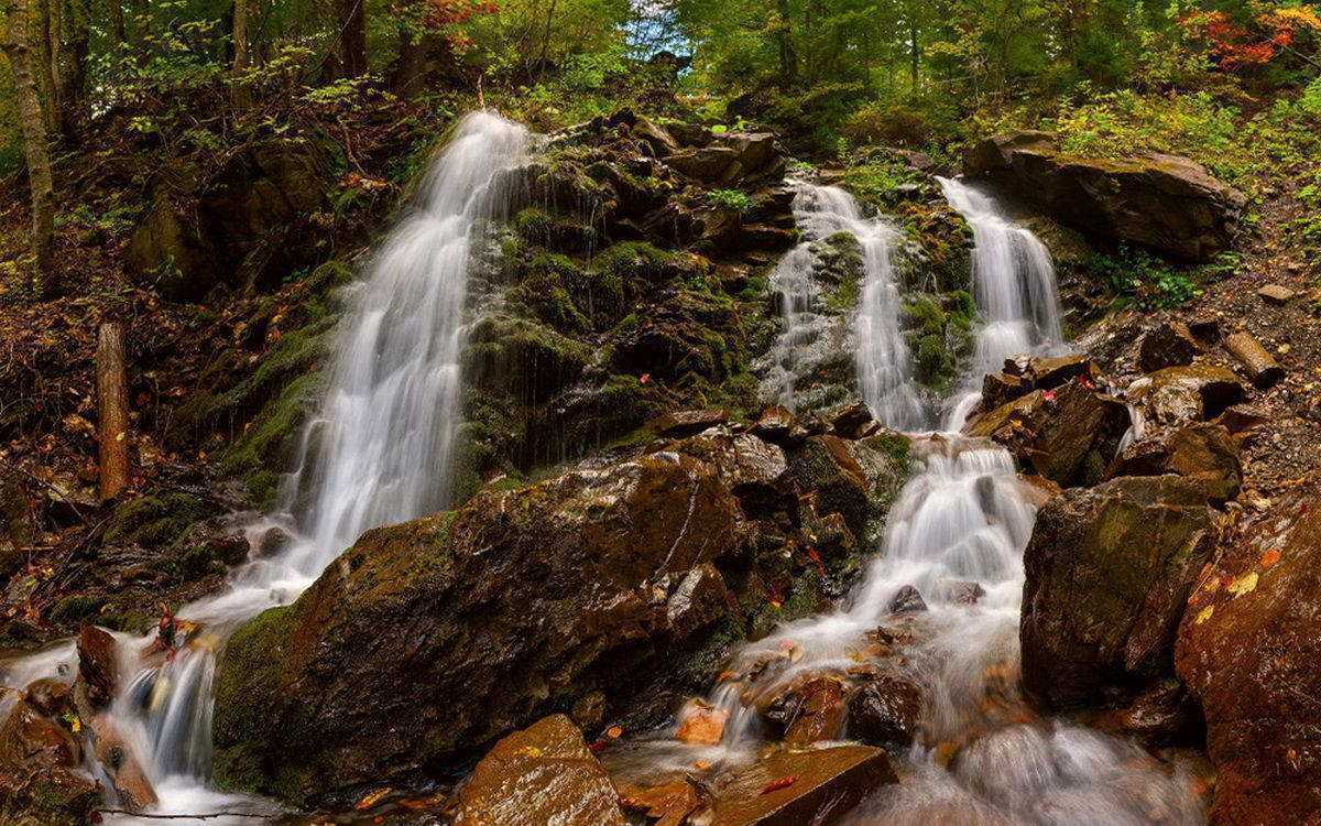
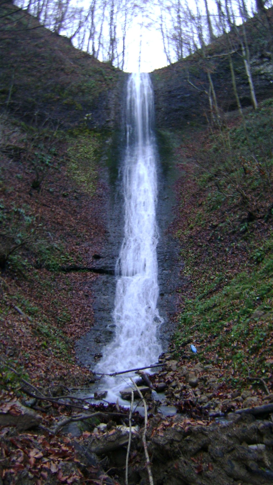
Trufanets
The highest waterfall in our region is 36 metres high and the stream is 2830 metres long. It is located on the southeastern slopes of the Svydovets mountain range, in Rakhiv district. It originates at an altitude of 1720 m at the foot of Mount Blyznytsia. It consists of picturesque cascades (there are more than five of them), formed at the site of erosion-resistant sandstone outcrops. The water flow flows into the Black Tisza, first overcoming 3 km of mountains, of which about 230 m flows underground. Trufanets is of great aesthetic and recreational importance and is located in the Carpathian Biosphere Reserve.
The waterfall is surrounded by forest, so it is quite cool in summer. It is quite easy to get to the waterfall, as it is located right by the road. To be precise, the natural wonder falls 7 km from the village of Kvasy and 2 km from the turn to the Dragobrat ski resort.
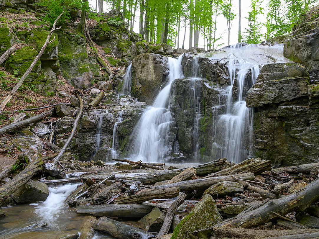
Skakalo
It is one of the smallest waterfalls in Zakarpattia, but this feature does not make it less attractive to tourists. It is located within the Vygorlat-Gutyn volcanic massif, in the Nyzhne Hrabovyshche tract, near Chynadiyevo, Mukachevo district. It is a natural monument of local importance with a total height of over 4 metres. The stream flows down in three small cascades from a stone ridge that crosses a forested hillside and flows into the Matekova River. The stream seems to jump from stone to stone, hence the name of the waterfall.
You can get to Skakal from the territory of the Vodohrai sanatorium. A marked path leads to the stream. When you reach the first cascade, don't stop and continue along the path and you will see an incredible sight.
Yalynsky
A waterfall in the Ukrainian Carpathians in the Rakhiv Mountains. It is located to the east of the village of Dilove, where the route to the Pip Ivan Marmarosky mountain passes. The height is 26 metres, it is a single-cascade waterfall. It is considered the highest single-cascade waterfall in the Ukrainian Carpathians.
The waterfall was formed in the natural place of the Yalyn River, whose water falls from a high rocky outcrop of Mount Shchevora at an angle of 85 degrees. The waterfall was mentioned as early as the twentieth century, and its name "Kovhaty" means "waterfall of a stone dam".
Tourists started visiting this natural site only 10 years ago. The waterfall is not easy to get to because of frequent elevation changes. The highest point of the Yalynsky waterfall is 1050 metres. The peculiarity of this beautiful waterfall is that the tourist route to the waterfall requires permission from the Border Guard Service, and in wartime it is prohibited by the Regional Defence Council.
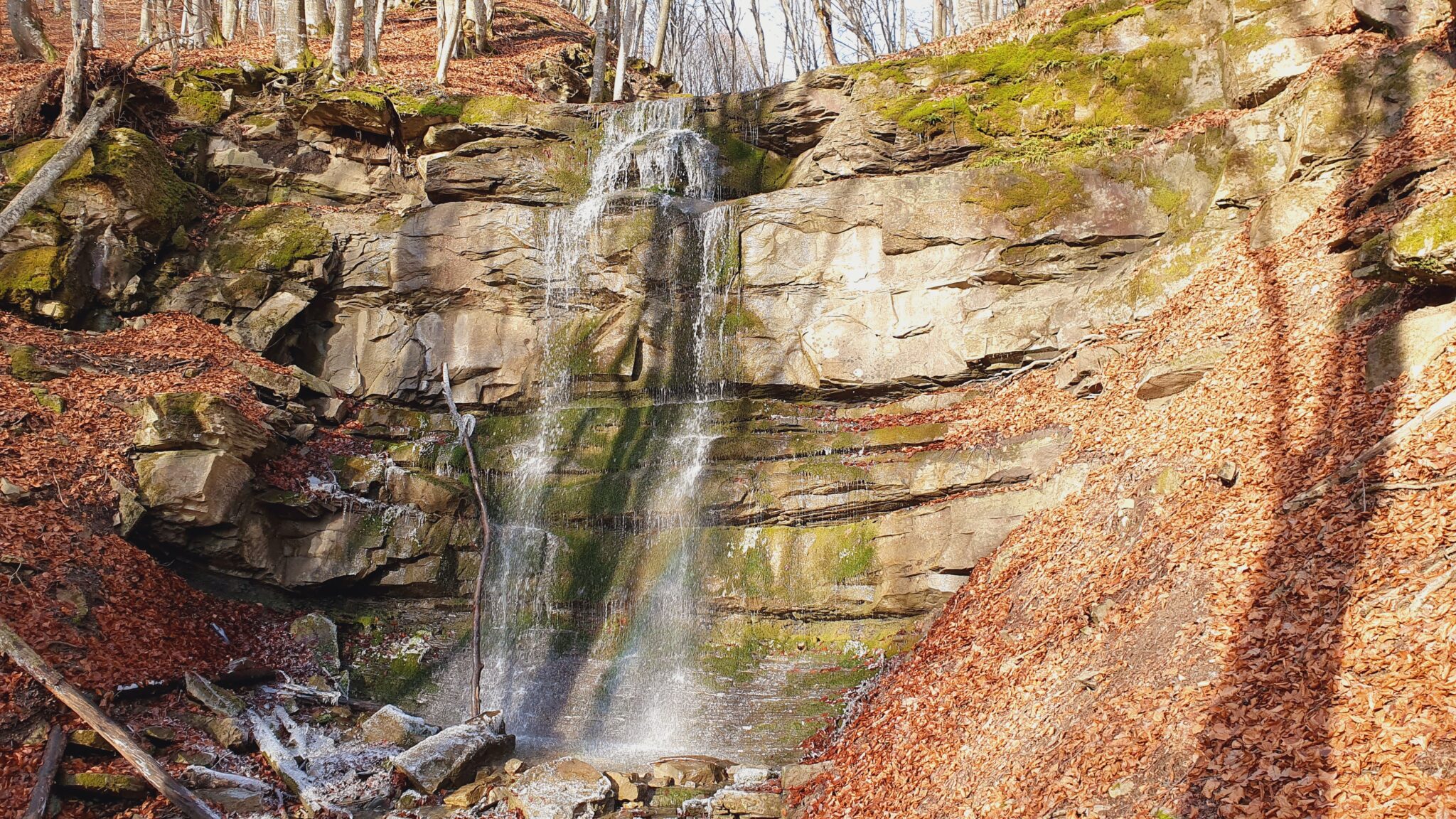
Gorodilovsky
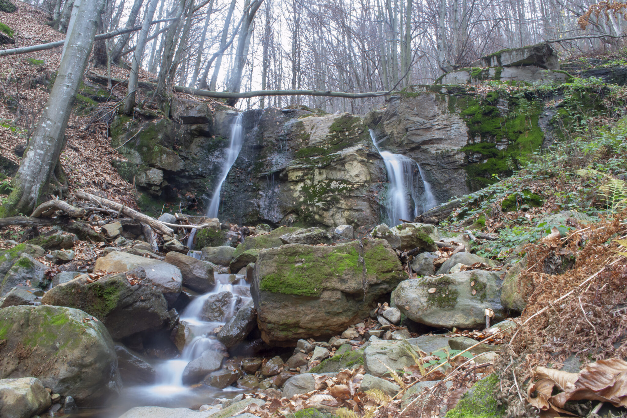
The Gorodyliv Waterfall is a system of cascading waterfalls in the Ukrainian Carpathians, in the Tupyi mountain range. It is a hydrological natural monument of local significance (called the Horodyliv Waterfall). It is located in Khust district, Zakarpattia region, 2 kilometres north of the centre of Zarichne village.
The waterfall is located in the upper reaches of the Horodyliv Stream (a right tributary of the Rika River), at an altitude of 450 m above sea level. The height of the water fall in the highest cascade is 5 m.
Vyshovatsky waterfalls
The Vyshovatsky waterfalls are located in the Transcarpathian lowlands of the Ukrainian Carpathians, within the Tyachiv district of the Transcarpathian region, on the eastern outskirts of the village of Vyshovatyi.
This is a system consisting of three waterfalls - Vyshovatsky Big (14 m), Vyshovatsky Middle (10 m) and Vyshovatsky Small (2 m). The Vashovatyi stream has the Vyshovatskyi Malyi waterfall, while the Velykyi and Serednyi waterfalls are located on short left tributaries. In dry times, the Vashovaty stream almost dries up, so the waterfalls have the highest flow after heavy rains or during thaws. The ledge and basin where the waterfalls are located are composed of pebble conglomerates. The Velykyi ledge in the lower part turns into a steep slope without a pronounced bottom. The middle ledge falls from a vertical wall.
Svydovets (Dragobrat waterfall)
Svydovets Waterfall is a cascading waterfall in the Ukrainian Carpathians (Svydovets massif), a hydrological natural monument of local significance. It is located in Rakhiv district, Zakarpattia region, to the west of Yasinia village.
The total height of the waterfall is about 7 m. It is located to the west of the campsite and the Dragobrat Valley, in the upper reaches of the Kisva River (Tisa basin), near Lake Gereshaska.
Lumshory waterfalls
Lumshory waterfalls are a group of waterfalls in the Ukrainian Carpathians, a hydrological natural monument of local significance (called "Waterfall on the Turytsia River"). They are located within Uzhhorod district of Zakarpattia region.
The waterfalls are located 3.5 km northeast of the village of Lumshory, on the Turychka River (a tributary of the Turya), near the northwestern slopes of Polonyna Rivna. The system consists of 5 waterfalls: Solovey, Burkach, Davir, Perestupen and Krutylo. In one of the highest waterfalls, called Davir, water falls from a cliff in a powerful, straight stream over 4 m high, forming a small lake at the foot.
Malotrostyanetsky waterfall
The waterfall is located in the eastern part of the Svydovets massif, within the Rakhiv district of Zakarpattia region, on the eastern outskirts of the village of Kvasy, in the village of Trostianets, 100 m from the H 09 road.
The waterfall is 4.5 m high and 3 m wide. It was formed on the Malyi Trostyanets stream (a right tributary of the Black Tisza). The water flow in several cascades runs down a rocky ledge with a pile of boulders. The waterfall is unequipped and its slopes are very rocky, which greatly impedes the descent.
Nire waterfall
It is located a few kilometres from the town of Khust. It was formed on the Nerish River, which is also one of the tributaries of the Tisa.
The waterfall is surrounded by small rocks that emphasise its unique beauty. Due to its location and low popularity, the waterfall has managed to preserve its authentic appearance.
Ilnychka
The waterfall is located 3.5 km from the village of Ilnytsia in Khust district, surrounded by the beech forest of the Zacharovany Krai National Park.
The name of the waterfall comes from the Ilnychka River. The height of the waterfall is about 5 metres.
The waterfall is located 3.5 km from the village of Ilnytsia in Khust district, surrounded by the beech forest of the Zacharovany Krai National Park.
The name of the waterfall comes from the Ilnychka River. The height of the waterfall is about 5 metres.
Stone
It is located in the Kuziysky protected area of the Carpathian Biosphere Reserve, within the Rakhiv district, west of the southern outskirts of Rakhiv, 1 km from the H 09 motorway.
The waterfall is 2.5 m high. It was formed on the Kamianyi Stream (a right tributary of the Tisza). The water flows through a rocky outcrop, which created a kind of gutter. The waterfall is especially full and picturesque after heavy rains. The waterfall is easily accessible but little known.
Kobyletskyi Huk
It is a cascade of waterfalls in the south of the Svydovets massif. It is located within the Rakhiv district, not far from the southern outskirts of Kobyletska Polyana village (Yurochkovo tract).
The total height of the waterfall is up to 22 m. The height of the highest cascade is 8 m. The waterfall was formed on the Yurochkovo stream (a right tributary of the Shopurka river), in the place where the stream crosses a blocky rock ledge. The waterfall is especially picturesque after rainfall or during snowmelt. In dry season, the stream almost dries up. It is easily accessible and little known.

No comment