
Beauty above the clouds
There are about thirty alpine lakes in the Carpathians. They are located mainly at an altitude of 1400 to 1800 metres above sea level within the Chornohora and Svydovets massifs.
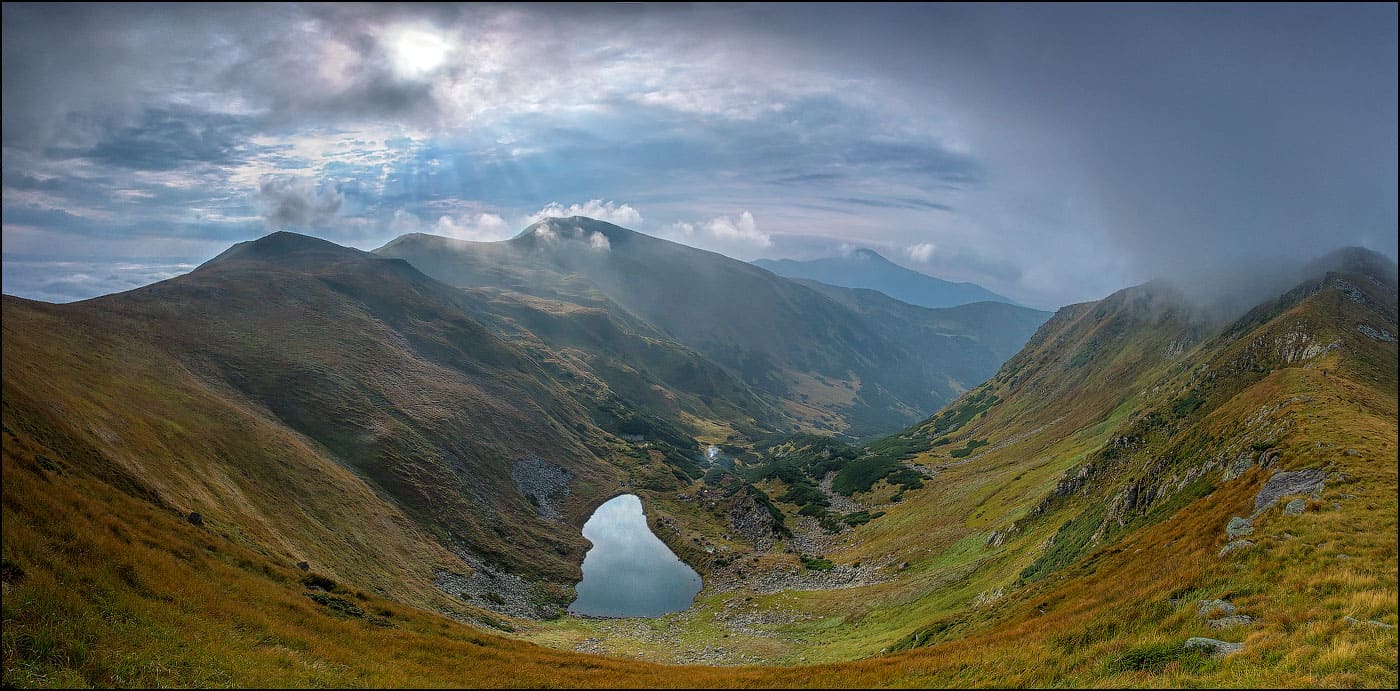
Brebeneskul (1801 m)
Lake Brebeneskul is a true Ukrainian miracle. Its uniqueness lies in the fact that the lake is the highest in Ukraine, at an altitude of 1801 m above sea level. Although the water in Lake Brebeneskul heats up to only 15 degrees, it is the warmest body of water in the Montenegrin ridge among 20 other lakes. The reservoir is fed by groundwater and precipitation, has a maximum depth of 2.8 metres and measures 67 by 147 metres. Although the water in the lake is clean and clear, it is not recommended for eating or drinking, as there is a spring nearby and the lake has a river of the same name.
The unusual name Brebeneskul translates from Romanian as "periwinkle", probably because of the blue waters of the lake, where the colour of the sky merges with the shades of the reservoir. However, tourists are attracted to this alpine beauty not only because of the incredible views, but also because of the mystery and some mysticism of this place. After all, there are many legends associated with the lake. Whether or not to believe the legends is a personal matter, but just in case, we advise you to be always ready for the whims of capricious nature. Here is a nice sunny day and suddenly a fierce wind with rain or hail comes down on the heads of tourists.
Many tourist routes pass near Lake Brebeneskul, most of them are designed for more than one day. It is known that today the lake is a part of the Carpathian Biosphere Reserve, which gives us hope for the preservation of this unique natural and tourist site and its purity for future generations who will visit these unique places of the Ukrainian Carpathians.
Nesamovyte (1750 m)
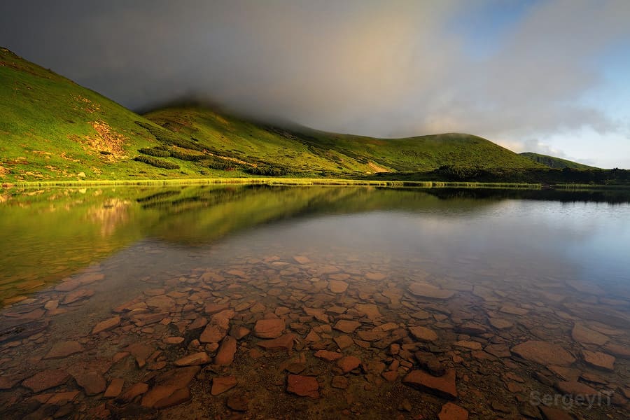
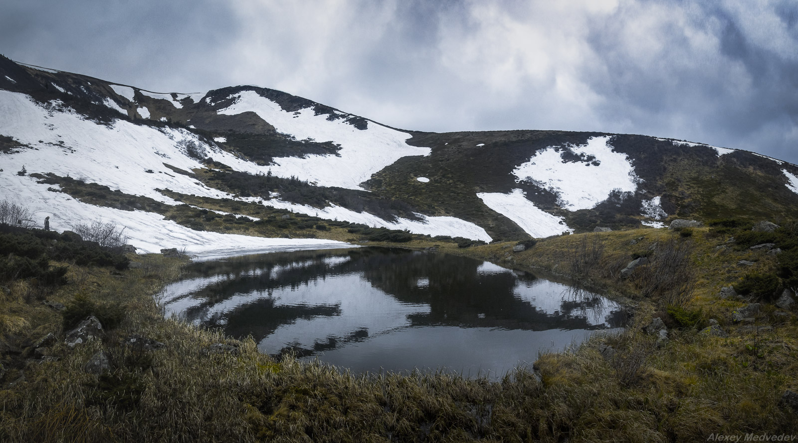
Nesamovite Lake is the second highest mountainous lake after Lake Brebeneskul. It is about 88 metres long, 45 metres wide, and shallow - 1-1.5 metres deep. The lake is of glacial origin, so the water in it is almost always quite cold. The lake is located on the border of Zakarpattia and Ivano-Frankivsk regions in the Chornohora massif at an altitude of 1750 m at the foot of Mount Turkul.
There is probably no place in the Carpathians with so many legends, tales and stories as Lake Nesamovyte. And when bad weather begins to rage around the lake, it seems that there is no place to escape... The locals have settled all sorts of creatures in the waters of Nesamovyte: strange creatures, souls of sinners, and the evil one... But despite all these beliefs, Nesamovyte attracts more and more ecotourism lovers every year with its incredible beauty and mystery. In order to preserve the beauty and uniqueness of this lake, a large number of environmental campaigns and clean-up events have been actively carried out recently.
Ivor or Dragobrat Lake (1600 m)
Lake Ivor is hidden in a hollow between the peaks of the Gendarmes and Bliznytsi mountains of the Dragobrat Range. This lake is of glacial origin. It is 55 metres long and 21 metres wide. The depth varies from 1.2 to 1.5 metres. The water, which comes from underground springs and precipitation, is fresh and always cool.
Blue as the sky, the lake looks unique against the green Carpathian slopes. It never ceases to attract tourists. The place is truly incredible. On the slopes of the mountains surrounding it, you can find a rare edelweiss flower listed in the Red Book of Ukraine. By the way, it is this flower that is associated with the romantic and sad legend of the lake. It is said that a girl named Ivor once lived in these parts and wished that two twin brothers in love with her would bring her a silky edelweiss from the steep slopes. The boys failed to hold on to the rocks and died, and the grieving girl cried over the whole lake, which was named after her, and the place where the boys fell was called Dragobrat.
Undoubtedly, the Carpathians can impress with their incredible beauty at any time of the year. However, summer is the best time to admire Lake Ivor. You will see amazing beauty - the Gorgany Ridge and the Chornohora massif with the Petros peak, and in the distance small mountain villages and meadows covered with white sheep.
Today, Lake Ivor is considered one of the cleanest parts of the Carpathians, so tourists should respect this fact and enjoy the unique scenery without harming the surrounding flora.
Today, Lake Ivor is considered one of the cleanest parts of the Carpathians, so tourists should respect this fact and enjoy the unique scenery without harming the surrounding flora.
Gereshaska (1577 m)
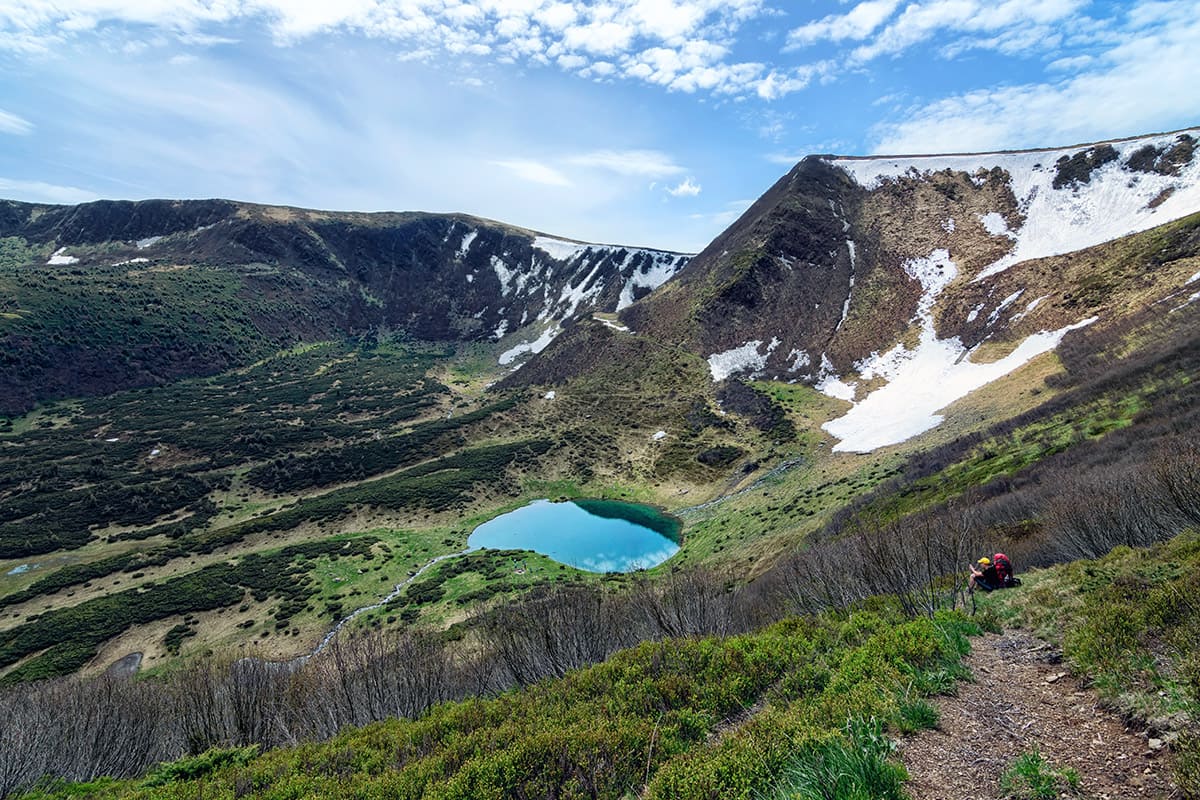
Lake Gereshaska is also known as Dogyaska or Sea Eye. The Ukrainian Carpathians have long attracted tourists with their majestic landscapes, fresh and clean air. Lake Gereshaska is a picturesque mountain lake of glacial origin located in the Svydovets massif in the Rakhiv district of the Zakarpattia region. Among tourists, it is better known as Dogyaska, as it is located on the southwestern slopes of the mountain of the same name. The picturesque views that open up on the slopes of this mountain will definitely not leave you indifferent.
Two mountains - Dogyaska and Geresaska - at the foot of which the lake lies at an altitude of about 1577 metres, form a real wall at its western edge, reaching almost 200 metres upwards. The reservoir is 125 metres long, 110 metres wide, and shallow - up to 1.2 metres deep. It is fed mainly by snow water. The best views of the lake, which has an interesting irregular rectangular shape, can be seen from the heights of the Apshinsky ridge.
If you come here during the blueberry season (or, as the locals call them, yafin), you can enjoy these healthy berries in abundance, as they grow everywhere.

Maricheika (1510 m)
In the Chornohora massif, on the northeastern slope of Mount Shuryn Gropa, at an altitude of 1510 metres, there is another alpine lake, Maricheika. It is of glacial origin and is fed by underground and atmospheric precipitation. The lake is 88 metres long and 45 metres wide. The water in the lake is clean, despite its shallow depth - a maximum of 0.8 metres. The shores are low, covered partly with subalpine meadows and partly with sedge thickets.
One of the highest peaks of the Ukrainian Carpathians, Pip Ivan Chornohirskyi (2022 m), is located to the northwest of the town. Maricheika is surrounded by a forest of spruce and mountain pine. Almost like every lake, Maricheika has its own sad legend, which tells of a brave girl named Marichka who defended her village from the enemy at the cost of her life. There are many trails to Maricheika, but the most convenient route is from the village of Shybene to the mountain of Pip Ivan Chornohirsky.
Apshynets (Trojaska, 1487 m)
Lake Apshynets is a small paradise in the Carpathian highlands. It is an oasis to which thirsty animals from the forests of the Apshynets Nature Reserve come - chamois and red deer. Lake Apshynets is a hydrological natural monument. It is located in the Rakhiv district near the top of Mount Troiaska at an altitude of 1487 metres. Apshynets is located at the bottom of a glacial carr and is up to 3.3 metres deep, 126 metres long and 100 metres wide. The water in the reservoir is clear and clean. The water temperature, even on the hottest days, is no higher than 12°C degrees, and in winter the lake is covered with ice. A small river, also called Apshynets, originates from the lake. Tourists call the lake Troiaska because it is located near the peak of the same name, which belongs to the Svydovets mountain range. From its shores, you can see not only the Svydovets mountain range itself, but also the incredibly beautiful Gorgan massif. To get to the lake, you can choose one of the routes that diverge from the ridge between Apshynets and Gereshaska in different directions: to Rakhiv, Ust-Chorna, Chorna Tysa and Kvasy.
Lake Apshynets is a small paradise in the Carpathian highlands. It is an oasis to which thirsty animals from the forests of the Apshynets Nature Reserve come - chamois and red deer. Lake Apshynets is a hydrological natural monument. It is located in the Rakhiv district near the top of Mount Troiaska at an altitude of 1487 metres. Apshynets is located at the bottom of a glacial carr and is up to 3.3 metres deep, 126 metres long and 100 metres wide. The water in the reservoir is clear and clean. The water temperature, even on the hottest days, is no higher than 12°C degrees, and in winter the lake is covered with ice. A small river, also called Apshynets, originates from the lake. Tourists call the lake Troiaska because it is located near the peak of the same name, which belongs to the Svydovets mountain range. From its shores, you can see not only the Svydovets mountain range itself, but also the incredibly beautiful Gorgan massif. To get to the lake, you can choose one of the routes that diverge from the ridge between Apshynets and Gereshaska in different directions: to Rakhiv, Ust-Chorna, Chorna Tysa and Kvasy.
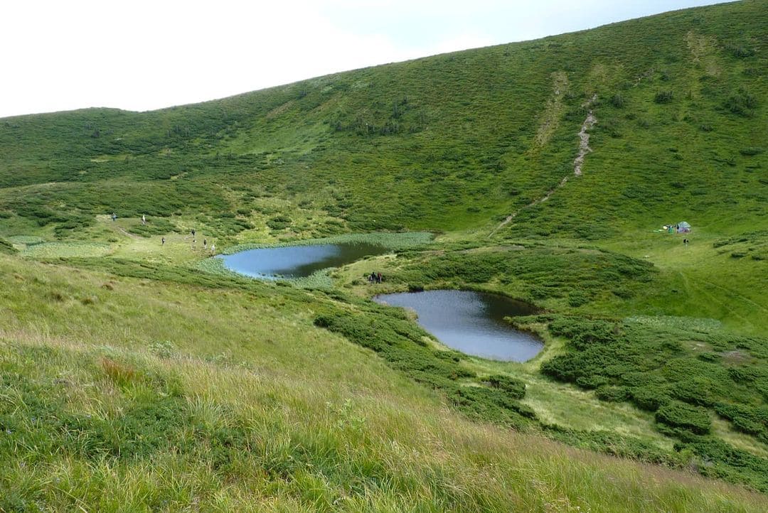
Vorozheska (1460 m)
Lake Vorozheska (also known as Triton) is a high-mountainous lake in the Ukrainian Carpathians, located within the Rakhiv district of Zakarpattia region at an altitude of 1460 metres at the foot of Mount Kotel. Vorozheska unites under one name two small lakes connected by a small stream. The first lake is 4.5 metres deep and 95 metres long, while the second (smaller) lake is about 2 metres deep and 76 metres long. The lakes were formed thousands of years ago as a result of glacial melt. The water in the lakes is clean, clear and warms up to only +12°C in summer.
It is interesting that there is a place very close to the lakes where there is almost always snow. And there are juniper and blueberry bushes around. The nearest settlement is the village of Chorna Tysa, not far from the village of Yasinia.
Legends have also not escaped this place. One of them tells about two friends who were grazing sheep in this area and died during a storm, and in their place lakes spilled over, which were named for the hostility of the region. Another story is about a love tragedy.
Today, when travelling in the Carpathians, no one is afraid of the area's charms. Lake Vorozheska attracts tourists, who make their way here in various ways.
Today, when travelling in the Carpathians, no one is afraid of the area's charms. Lake Vorozheska attracts tourists, who make their way here in various ways.
Lake "Synevyr" - genuineя pearl of the Carpathians
Synevyr Lake is truly considered one of the wonders of Ukraine. It is located in the protected area of the eponymously named Synevyr National Nature Park. It is the largest mountain lake in the Ukrainian Carpathians, with a maximum area of 7.5 hectares and a depth of 23 metres. The water level in the lake varies in different seasons. It reaches its maximum in spring, when snow melts in the mountains and heavy rains fall.
The lake is located between the mountains, in a spruce forest at an altitude of 989 metres above sea level. Scientists claim that it was formed about 10-11 thousand years ago. Although scientists have answered the question about the origin of the mountain lake, legends are firmly entrenched in the people, which tell a completely different story.
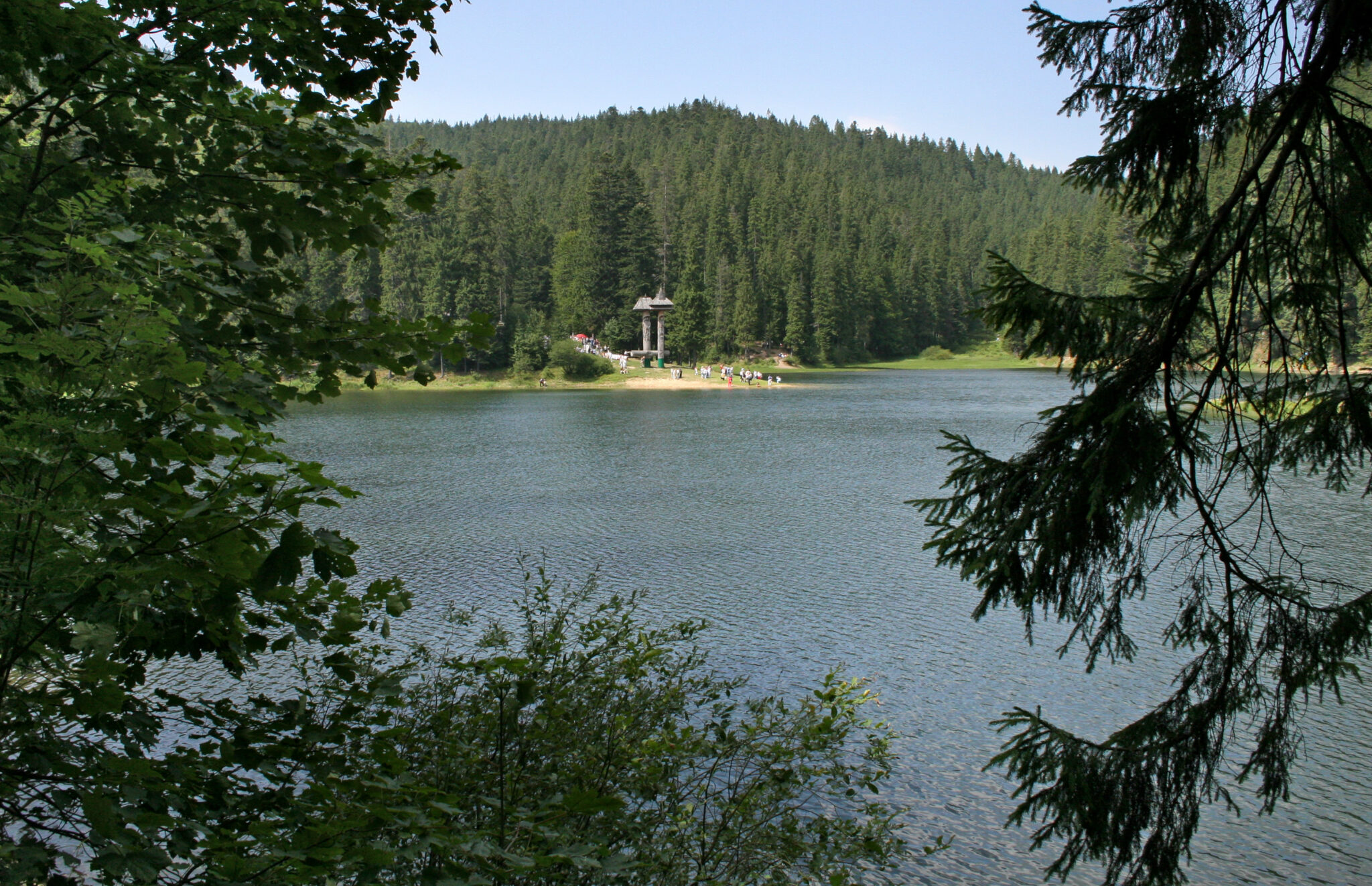
The most widespread legend is about the love of the count's daughter Syni and the poor shepherd Vyr. Syni's tears for her beloved created the whole lake Synevyr, poetically called the Sea Eye. From a bird's eye view, it really resembles an eye. The island in the middle is like the pupil of the eye, and the long spruce branches are like fairy eyelashes.
Of course, legends are a significant part of local folklore, as is the Synevyr, a valuable natural heritage that was granted Ramsar status in 2005, which confirms the international significance of this natural site.
There are eco-trails for tourists around Lake Synevyr, a motel, a restaurant, a children's playground, and popular horseback riding.
Not far from the Synevyr Lake, there is another equally significant place - a rehabilitation centre for brown bears. The rehabilitation centre is the largest targeted project in Europe, which was created with the direct involvement of the state and people who are not indifferent to this problem. It is here that bears that have been abused in captivity have the opportunity to adapt to normal natural living conditions.
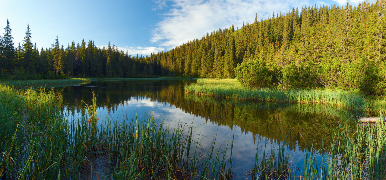
Lake Synevyr and its surroundings are a place of extraordinary beauty and untouched nature. It is home to 150-year-old pines and spruces. And 38 species of plants and 20 species of animals are listed in the Red Book of Ukraine. And if you stop at the top of the Synevyr Pass and look around at the blue-green horizons of the Carpathians: to the west you can see the Borzhava mountain range, to the south the Ovechiy Verkh range stretches, to the southeast rises Mount Strymba (1719 m), and to the north is Mount Kamyanka (1578 m). Far below, the houses of the village of Synevyr are scattered, and the mysterious Tereblya River stretches as a ribbon of unusual green colour.
The article uses photographs by Olena Kravchyshyn, Andrii Marushchynets, and Yaroslav Tiurmenko.
Of course, legends are a significant part of local folklore, as is the Synevyr, a valuable natural heritage that was granted Ramsar status in 2005, which confirms the international significance of this natural site.
There are eco-trails for tourists around Lake Synevyr, a motel, a restaurant, a children's playground, and popular horseback riding.
Not far from the Synevyr Lake, there is another equally significant place - a rehabilitation centre for brown bears. The rehabilitation centre is the largest targeted project in Europe, which was created with the direct involvement of the state and people who are not indifferent to this problem. It is here that bears that have been abused in captivity have the opportunity to adapt to normal natural living conditions.
Lake Synevyr and its surroundings are a place of extraordinary beauty and untouched nature. It is home to 150-year-old pines and spruces. And 38 species of plants and 20 species of animals are listed in the Red Book of Ukraine. And if you stop at the top of the Synevyr Pass and look around at the blue-green horizons of the Carpathians: to the west you can see the Borzhava mountain range, to the south the Ovechiy Verkh range stretches, to the southeast rises Mount Strymba (1719 m), and to the north is Mount Kamyanka (1578 m). Far below, the houses of the village of Synevyr are scattered, and the mysterious Tereblya River stretches as a ribbon of unusual green colour.
The article uses photographs by Olena Kravchyshyn, Andrii Marushchynets, and Yaroslav Tiurmenko.

No comment