
Rakhiv district
![]()
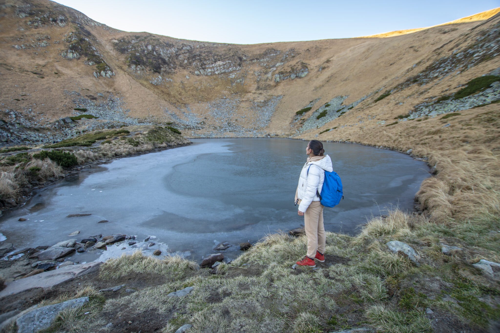
Incredible landscapes formed by magical forests and high mountain valleys, unique lakes formed since the Ice Age, healing mineral springs - all this creates the uniqueness of Rakhiv district among other districts of Transcarpathia.
Rakhiv district is the highest mountainous region of Ukraine, located in the eastern part of Zakarpattia, bordering Ivano-Frankivsk region and Romania.
Due to its geographical location, unique nature and distinctive Hutsul culture, the district centre of Rakhiv and Rakhiv district are known as one of the most popular tourist and recreational centres in Ukraine.
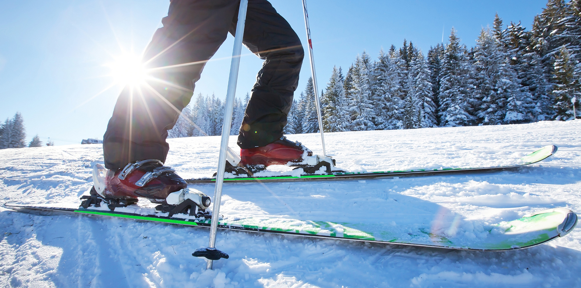
The district is home to the popular Dragobrat ski resort, which has the longest snowfall of any Ukrainian ski resort - from December to May inclusive. The highest peak of Ukraine, our proud Mount Hoverla (2061 m), is located in Rakhiv district. It is from Hoverla that a unique landscape opens up and a sense of true beauty is realised. Near Hoverla there are other mountains of two thousand metres: Brebeneskul, Petros, Pip Ivan Chornohirsky (Black Mountain), Rebra, Gutyn Tomnatyk and Menchul.
There are karst caves in the vicinity of Dilove and Kostylivka villages. There are mineral water springs in the town of Rakhiv, the villages of Kvasy, Bilyn, Bohdan, Kobyletska Polyana have mineral water springs, and there are more than 80 in the district.
Natural sites that are the pride of Transcarpathia
The district is home to the Carpathian Biosphere Reserve, which is one of the largest and most interesting institutions of the Ukrainian nature reserve fund, as it protects a significant number of natural sites. The value of its ecosystems has been recognised internationally - since 1993, the reserve has been a member of the UNESCO Biosphere Reserve Network;
- Between the villages of Kvasy and Yasinya is the Trufanets Waterfall (36 m), which adorns the Ukrainian Carpathians. The mountain waterfall originates from the southeastern slopes of the Svydovets ridge at an altitude of 1720 m, from under Mount Blyznytsia, from subalpine forests and meadows;
- The most famous lakes of Rakhiv district are: Lake Gereshaska, an almost rectangular picturesque lake that feeds the Kisva River, located under a rocky wall at an altitude of 1577 m; Lake Vorozheska at an altitude of 1460 m; Lake Apshynets, located at an altitude of 1500 m with clear water and brook trout;
- One of the largest tributaries of the Danube River, the Tysa River, which is formed by the confluence of the Black and White Tysa 4 km upstream from the centre of Rakhiv, originates in the district;
- There are unique monuments of wooden architecture in the district, including the most famous Church of the Ascension (Strukivska, 1824) with a bell tower (1813), Yasinia village (UNESCO heritage site), St Michael's Church (1870) in Bilyn village, Church of the Assumption of the Blessed Virgin Mary (1750), Dilove village. Dilove, the Church of the Transfiguration of the Lord with a bell tower (1780), Lazeshchyna village, the Church of Saints Peter and Paul (1827), Lazeshchyna village, St Nicholas Church (upper) with a bell tower (1428, 1600, 1760), Serednie Vodyane village, St Nicholas Church (lower, mid-17th century), Serednie Vodyane village, the Church of the Myrrh-Bearing Women with a bell tower (1856), Stebnyi village.
What else to see in Rakhiv district?
- Museum of Mountain Ecology of the Carpathian Biosphere Reserve (Rakhiv);
- the symbolic Centre of Europe, Dilove village;
- The Menchul Kvasivskyi meadow is the territory of the biological station of Lviv University, created to preserve and enrich the existing collections of rare plants;
- Dovgyi Potik tract - a place of berry yew growth;
- The south-western slope of Mount Pip Ivan Chornohirsky is a place of growth of a rare endemic plant, the Eastern Carpathian rhododendron;
- the Svydovets rocks, in the rocks of which imprints of flora and fauna were found;
- Trostynets rock is a stratigraphic natural monument (stratigraphy is a section of historical geology that covers the historical sequence, primary relationships and geographical distribution of sediments, volcanogenic and metamorphic formations that make up the Earth's crust and reflect the natural stages of development of the Earth and its biosphere);
- Strimchak rock, near the village of Dilove - an outcrop of white, black, grey and green marbles;
- Rock of Love, near the village of Kostylivka.
Rakhiv district has a lot to offer tourists. For example, the largest number of ski slopes in Transcarpathia (Dragobrat, Rakhiv, Bogdan, Kobyletska Polyana, Chorna Tysa, Lazeshchyna, Yasinya), with chairlifts, anchor lifts and rope tows, are open for winter recreation.
Other forms of active tourism are also popular, including mountain biking, hiking routes along the trails and in the surroundings of the Rakhiv district.
Treatment and rehabilitation services are provided at the Girska Tysa sanatorium in the village of Kvasy.
Among the most famous gastronomic festivals in the Ukrainian Carpathians is the Hutsul Brynza festival (Rakhiv). Other notable festivals include the Berlybash Banosh festival in Kostylivka and the Stuffed Cabbage Festival in the village of V. Bychkiv.
In Rakhiv and the villages of the district, there are campsites, hotels and rural estates that welcome tourists, and numerous restaurants and kolybas offer delicious Hutsul cuisine.