
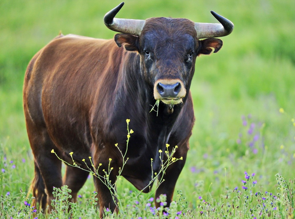
Intro
Today you will get acquainted with the Berehove region – a unique part of the Zakarpattia region that welcomes guests with sunshine, aromatic wine, and miraculous thermal waters. Here, local residents speak several languages, almost everyone has a vineyard in their yard, and if you ask what time it is, it’s better to specify whether you mean Kyiv time or local time.
Hat
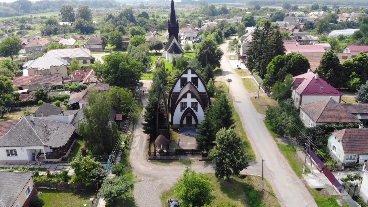
We’ll begin our journey with the village of «Hat».
The area of Hat village was settled even before the Hungarians developed the region. The name of the village apparently comes from the Slavic word “hat” – in this once swampy area around the large, now drained Lake Serne, people settled by building dams on lands reclaimed from the swamp. Although this was far from the easiest task, the settlement was better protected from enemy invasions, particularly the Mongols.
Work on draining the lake began in the 19th century and lasted almost a hundred years.
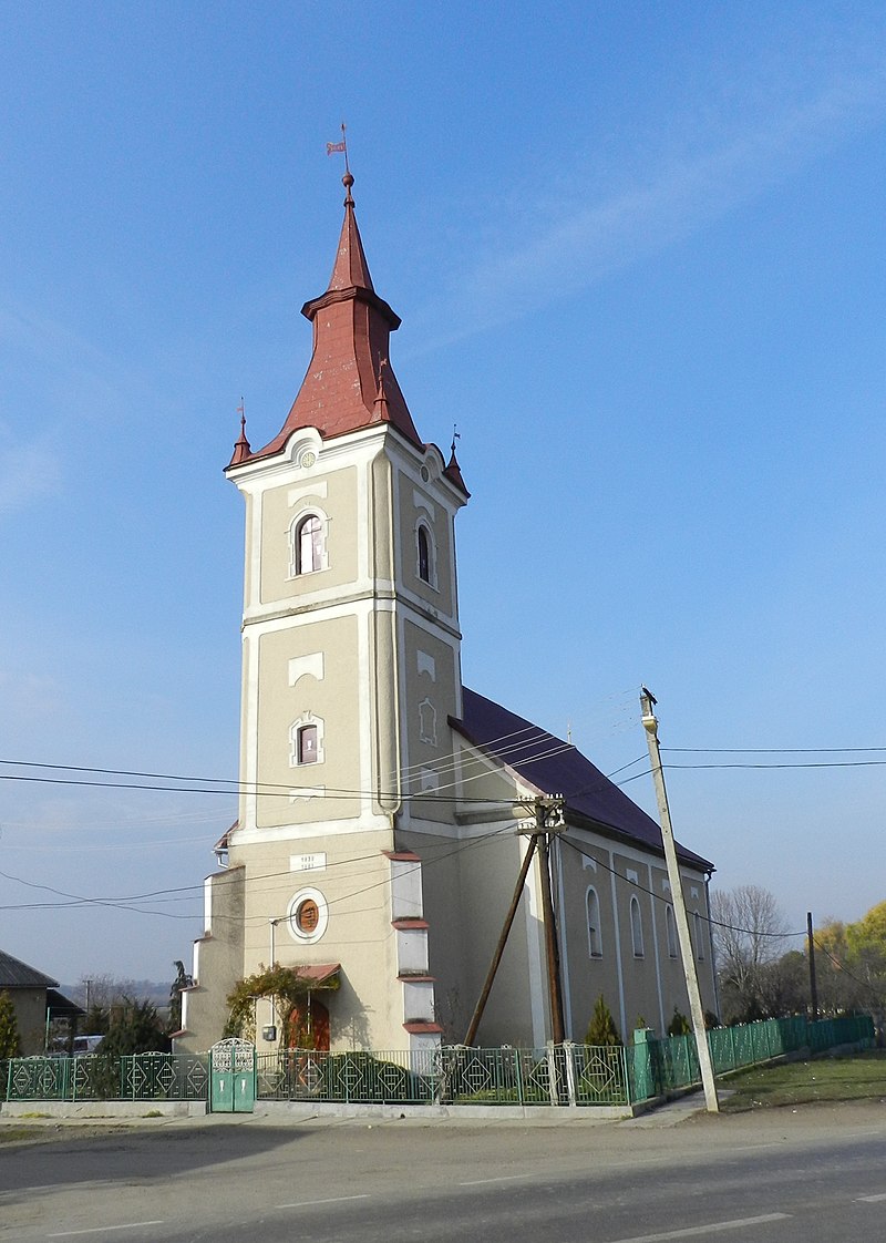
Now in the village, you can find many roadside traders who are happy to treat you to homemade products and sell goods from all over Hungary. Of course, you can also find a Protestant church in the village, which was characteristic of all villages in the region – the local population showed their protest against the Austrian crown in this way as well.
The famous Transcarpathian poet and writer Vilmos Kovacs and opera singer Gizella Cipola, who won the international vocal competition in Tokyo in 1976, were born in the village.
Yanoshi
Our next stop was first mentioned in the 14th century as “Ivanoshi”, meaning Ivan’s.
At that time, it was under the management of Queen Erzsebet, and in the records of the 17th century, an oak forest near the village is mentioned, which was called the “princess’s hill”.
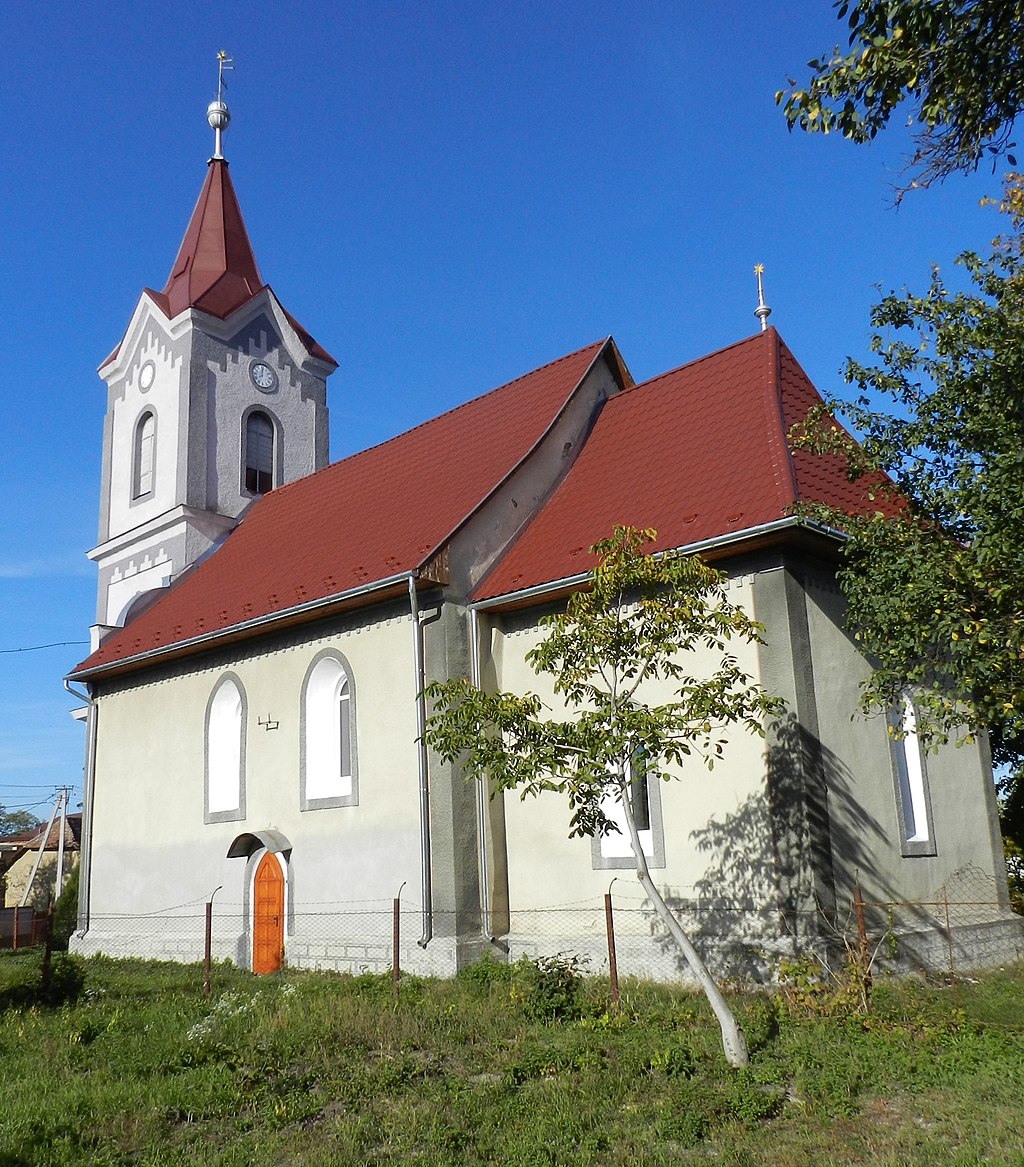
There is a Protestant church on the territory of the village, which is typical for this area. It was built sometime in the 14th century in the Gothic style, but has seen many reconstructions throughout its history. There could have been many reasons for such reconstructions of medieval temples: destruction by the enemy, the consequences of floods, and the banal need to expand the temple due to population growth.
Near the village council, on T. Shevchenko Street, you can see a carved monument to Prince Ferenc Rakoczi II. He was the Prince of Transylvania, the leader of the anti-Habsburg national liberation war of the Hungarian people in 1703-1711, and the owner of Mukachevo Castle Palanok. As you understand, he was a very important historical figure for Hungarian history and one of the symbols of the struggle for freedom and independence.
Velyka Byyhan
Just 4 km north of Dyida, and you’re in the village of Velyka Byyhan, which became the property of the Behani family in the 11th century. Nearby is Beyhanska Mountain, which is covered with vineyards. The village has preserved a Protestant church, where you can see a unique fresco depicting Saint Helena, dating back to the 15th century, although the church itself has been rebuilt several times and changed hands.
On the other side of the Reformed church, not far from it, stands an interesting object of industrial architecture – a grain storage facility, built in 1908, and still operating. The storage belonged to the local landowner Istvan Nemesh, and is now collectively owned by several local families.
Practically opposite the grain storage, Nemesh’s estate, built at the end of the 19th century, has been preserved. The estate is located next to the large House of Culture building, constructed in the late 1980s. Now it houses the village council, post office, library, and dental department.
You can also find Roman and Greek Catholic churches in the village. There is also a small park area with a statue of Turul – a mystical bird, a symbol of the Homeland, which led the Hungarian people to the place of modern Hungary.
The village has many estates where you can stay overnight, as it is located between two resort areas of the Berehove region – Koson and Dyida.
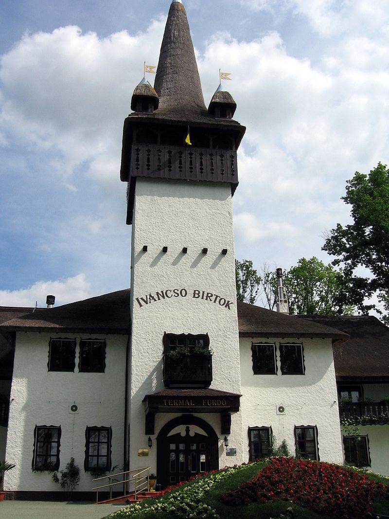
Косонь
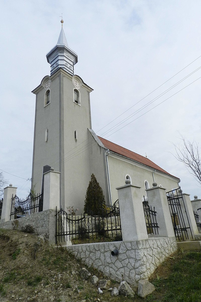
Koson is located near the Ukrainian-Hungarian border. It is believed that it was here that the King of Hungary, Laszlo I the Saint, defeated the Cuman army in a difficult battle in 1086. A church was built on the site of the victory, which is now used by the Reformed community of the village and is located at 1 Kotolin Street. The church was built in honor of Saint Catherine. Unfortunately, the appearance of the medieval church has changed many times as a result of reconstructions and additions, but even in its modern form, which was formed in 1902, the main tower of the church has preserved its medieval style.
And at 2 St. Istvan Street stands the Roman Catholic church of the village, inside which an organ from the Riger company, made in Budapest, has been preserved.
A very interesting building is the Eotvos Palace, which lies under a hill next to the Catholic church. This is the oldest secular building in the village and one of the oldest examples of this architectural type not only in the Berehove district but also in Zakarpattia. The one-story estate was built in 1703 by the Racz family. On the back wall of the building, the Racz family coat of arms with the numbers “1768” has been preserved.
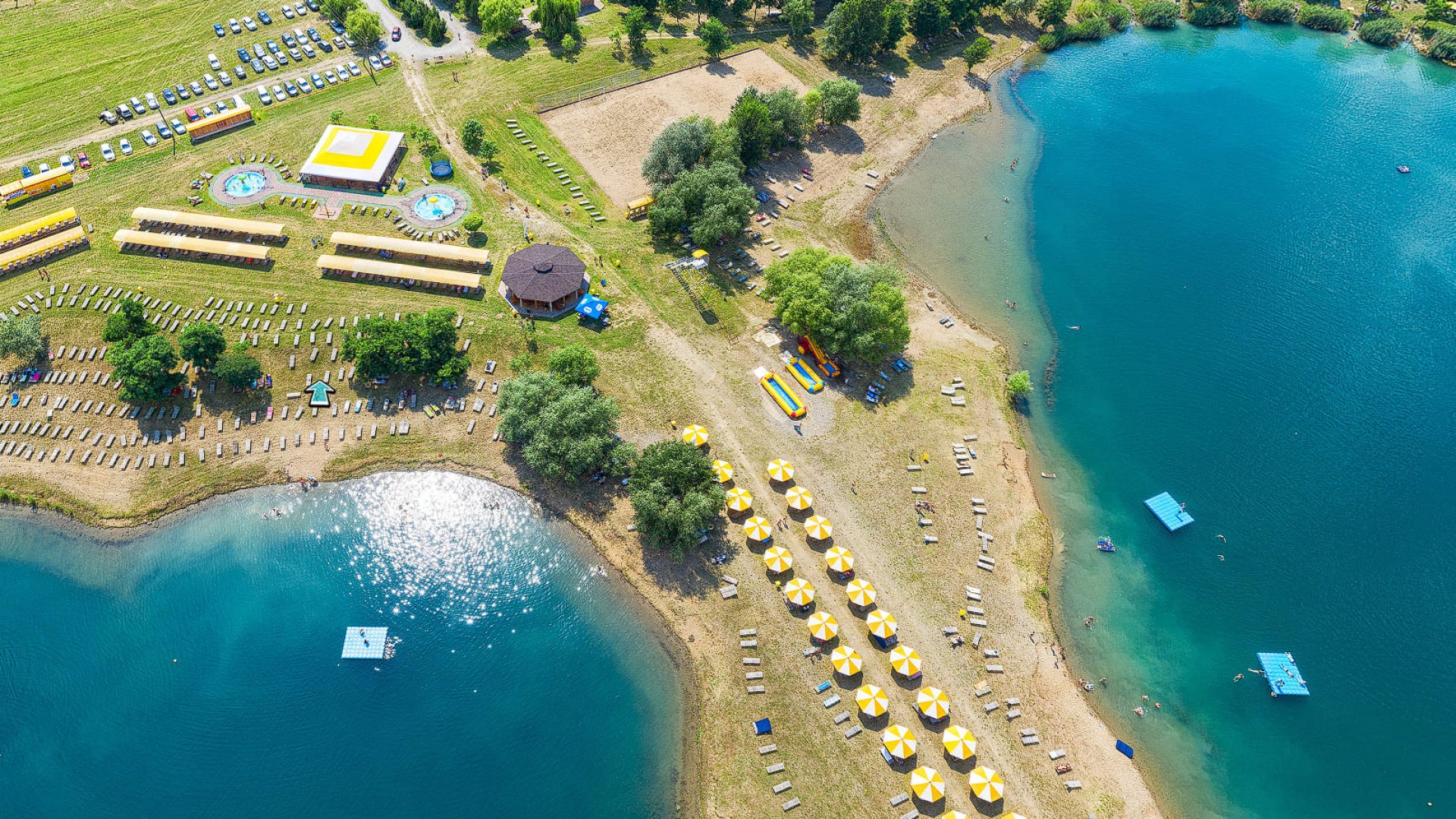
Tens of thousands of tourists annually visit the “Kosino” thermal water complex, which is clearly visible from the main road. The thermal water of the resort is filled with minerals, nutrients, and trace elements from iron to magnesium. The water itself is extracted from wells over 1,200 m deep, and its temperature at the outlet is 42 degrees Celsius. Treatment here has a toning effect on the skin and helps people with diseases of the cardiovascular, musculoskeletal, and nervous systems. Also, there is a hotel, spa, restaurant, and modern water park on the territory.
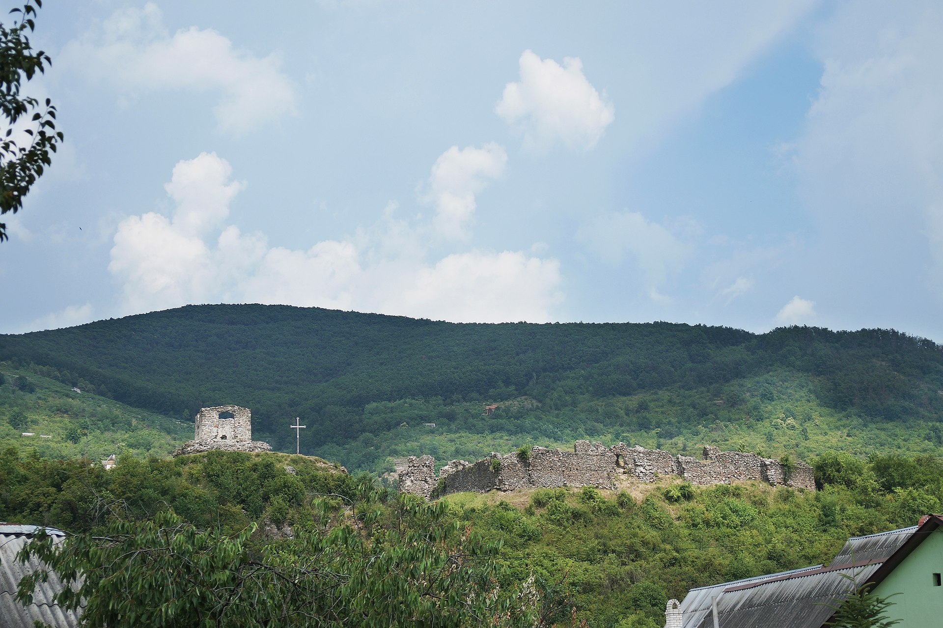
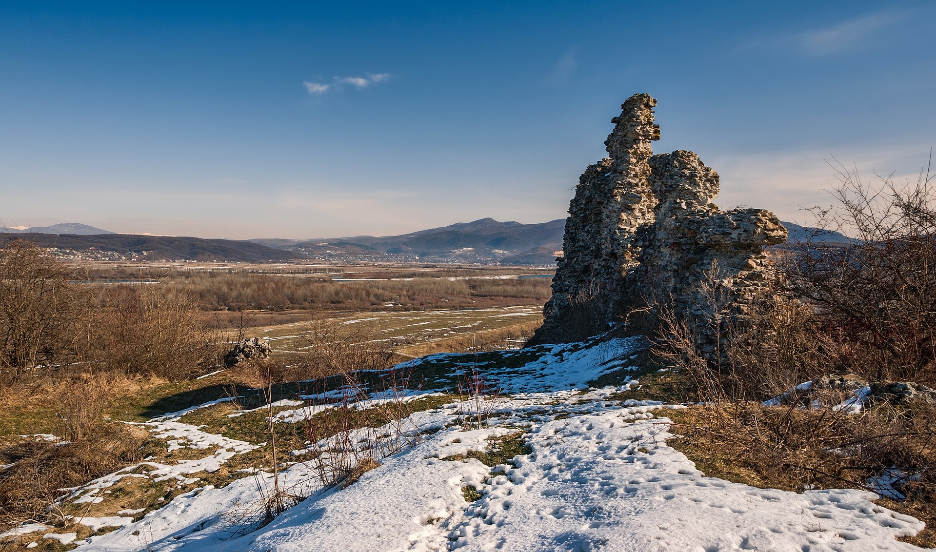
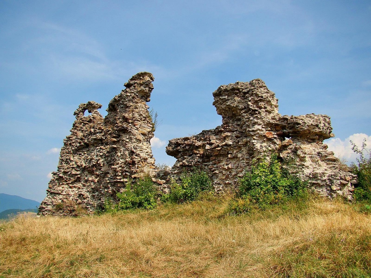
Dyida
Our next stop is the village of Dyida. Dyida, or “Deda” was first mentioned in the 14th century. Interestingly, even then the village had an important role in the region and there was an earthen castle To-var, which can be literally translated as a fortress on the lake. Interestingly, the fortification was also called “Várszég” by the people, literally meaning “castle-nail”. Access to the fortress was carried out using two wooden bridges on piles driven into the swampy ground. This allowed for effective defense of the settlement from enemy attacks.
Today it is an archaeological site that has been repeatedly studied by both researchers and treasure hunters.
At 147 Arpad Street, you can find a medieval temple from the 13th century, which is now a Reformed church. Although the temple has been restored and partially rebuilt inside several times, buttresses and Romanesque windows have been preserved.
Today, the village is a popular tourist destination, as the site of an old sand mine is now Lake Dyida and the Boomerang resort area, which is equipped with a beach and guest houses.
Berehove
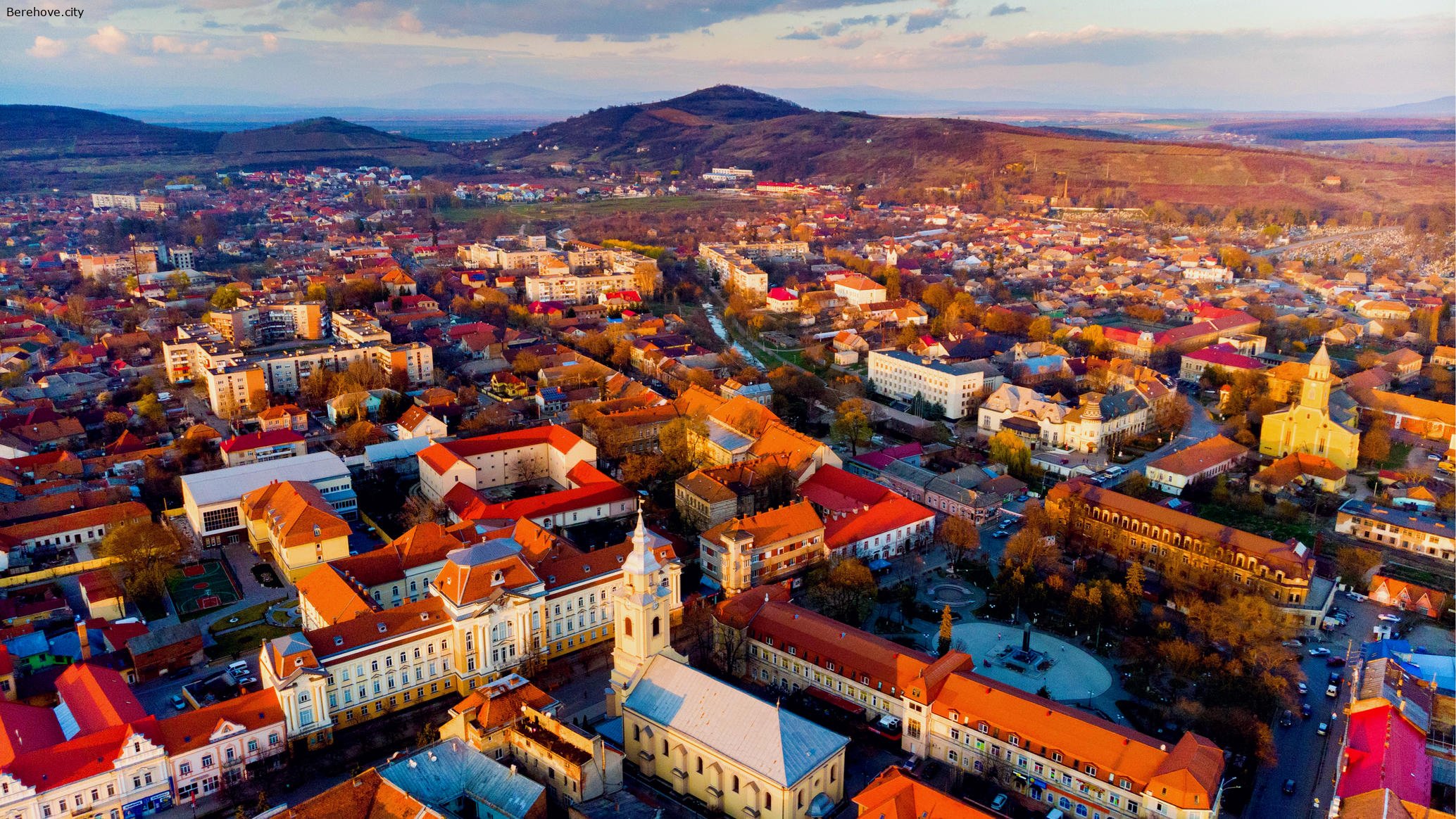
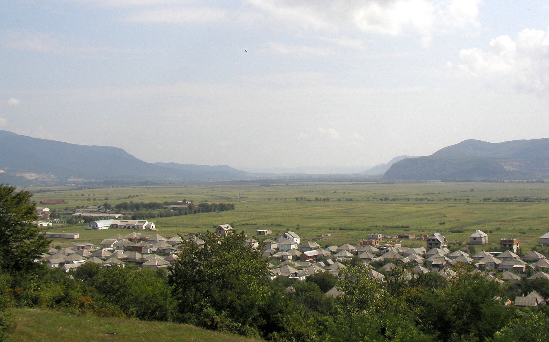
The Berehove region was developed quite a long time ago. Just imagine, remains of settlements that are over 12 thousand years old were found on the territory of the city. However, we won’t dig that deep into history. So let’s talk about the founding of the city in the 11th century and its subsequent history.
Lampertháza, or “Lampert’s home” if translated literally. This is how the settlement founded by the son of the Hungarian King Bela I was named in 1063. Most of the Berehove region is lowland, which was very convenient for life and agricultural development, and the small hills of the Berehove low mountains are perfect for growing grapes. The favorable location also contributed to the important role of the city in the region: in 1271, Berehove became the center of Bereg County – an administrative-territorial unit in the Hungarian Kingdom. Later, the city became a significant trade center with the right to hold fairs, and in 1342 it received the status of a royal city, which provided significant privileges for the development of the city and crafts. Unfortunately, the city repeatedly suffered from enemy attacks: in the 13th century, Khan Batu attacked, in the 16th – the Tatars, and in the 17th – the troops of the Polish king and Austrian Habsburgs. At the beginning of the 18th century, the city actively participated in the national liberation uprising against Habsburg rule, and after its suppression, the lands of the Berehove region passed to the famous Schönborn family, which in the 18th-19th centuries actively promoted the development of industry, agriculture, and crafts in Zakarpattia.
At 1 Bethlen Street, you can see the oldest secular building in the city. This is the palace of the Transylvanian prince and Hungarian king Gabor Bethlen, the construction of which dates back to the 16th century. However, during the uprisings at the end of the 17th century, the building almost completely burned down. It is believed that Prince Ferenc Rakoczi II rebuilt the palace. The Baroque-style building is divided into economic and residential parts.
Very close by, at 3 Rakoczi Square, is one of the oldest stone structures in Zakarpattia. This is the Church of the Exaltation of the Holy Cross, which welcomed parishioners back in the 12th century. Of course, the church, built in the Romanesque style, looked completely different then, but from those times, two embedded capitals decorated with a stylized male head and a lion have been preserved in the Northern portal. The Southern portal is more richly decorated and is perhaps the most sophisticated example of Gothic architecture in the region. In 1899, the temple was enriched with an organ from the famous Budapest company of the Rieger brothers. At the entrance to the church, there is a bust of the first Hungarian king – Istvan (Stephen) the Saint, and on the walls of the temple – memorial plaques to Prince Lampert, King Bela IV, and priest Ferenc Pastor.
Opposite the Roman Catholic church are two statues dedicated to the Hungarian people’s struggle against Austrian oppression – the leader of the peasant rebels Tomas Esze and the revolutionary poet Sandor Petofi. The city made a good impression on the poet: “Beregszász is a simple, cozy and small town, but what a great Gothic church it has, and even the innkeeper is Hungarian!”.
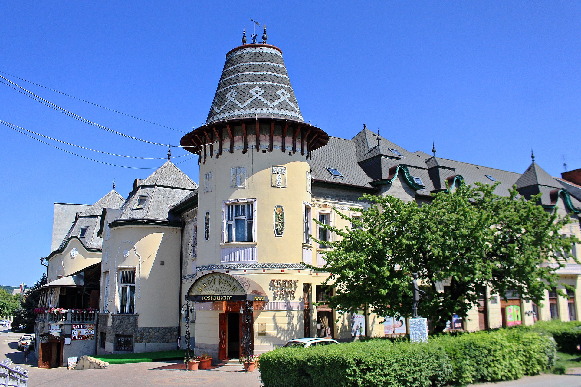
Near the humpbacked stone bridge and the Verke River, at 1 Rakoczi Square, is the “Golden Peacock”, which is now a hotel and restaurant. At one time, the Hungarian National Casino was located here. It was not just a place where gambling enthusiasts gathered. Citizens united by common interests, aristocracy, and educators who wanted to develop their native city gathered here. Very often, participants organized balls, classical music concerts, literary evenings, lectures, and debates.
At the intersection of Mukachivska Street and Heroes Square, you will see the building of the “Oroslan” hotel, which was founded in the distant 17th century and became the first hotel in the city of Berehove.
The building is characterized by features of the Baroque architectural style. Today, the building houses the Berehove Hungarian National Theater named after Gyula Illyés, which was founded by a bilateral agreement between the Ministries of Culture of Ukraine and Hungary in 1993.
In the “Budapest” park, guests and residents of Berehove are greeted by an equestrian statue of Ferenc II Rakoczi. The bronze statue is placed on a 20-ton pedestal made of limestone and weighs over one and a half tons. The total height of the monument is 6.3 meters. The authors of the masterpiece are sculptors Lajos and Adam Gyorfi. The bronze casting was performed by Imre Varga, and the stone carving by Lajos Bachi. The outstanding military leader Ferenc Rakoczi, sitting on his horse Panduri, symbolizes the struggle for freedom. In May 1703, he rebelled against the ruling Habsburg dynasty, which imposed exorbitant taxes on the population and exerted military pressure on those who tried to resist their will.
On Lajos Kossuth Square, you will see the Reformed church, which is the largest in the city and simultaneously accommodates 1100 parishioners. Inside is a beautiful organ by the Rieger brothers. Yes, you’re not mistaken. Almost half of the organs in Ukraine are located in the churches of Zakarpattia.
A true decoration of the city is the building of the former county court, which is located at 6 Lajos Kossuth Square. The palace was built in 1909 according to the project of architects Ferenc Jablonski, Istvan and Janos Kopas. The palace was built in the neo-baroque style with elements of Renaissance architecture. The courthouse was the tallest and largest in the city, and in the rear part of the three-story building was a prison.
Since 2002, it has housed the Ferenc Rakoczi II Transcarpathian Hungarian Institute.
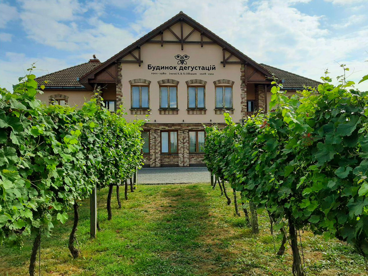
On Vynohradna Street, you can find a number of cellars where local winemakers store their wine. Some of them have tasting rooms. Families here pass down winemaking traditions from generation to generation and always warmly welcome guests.
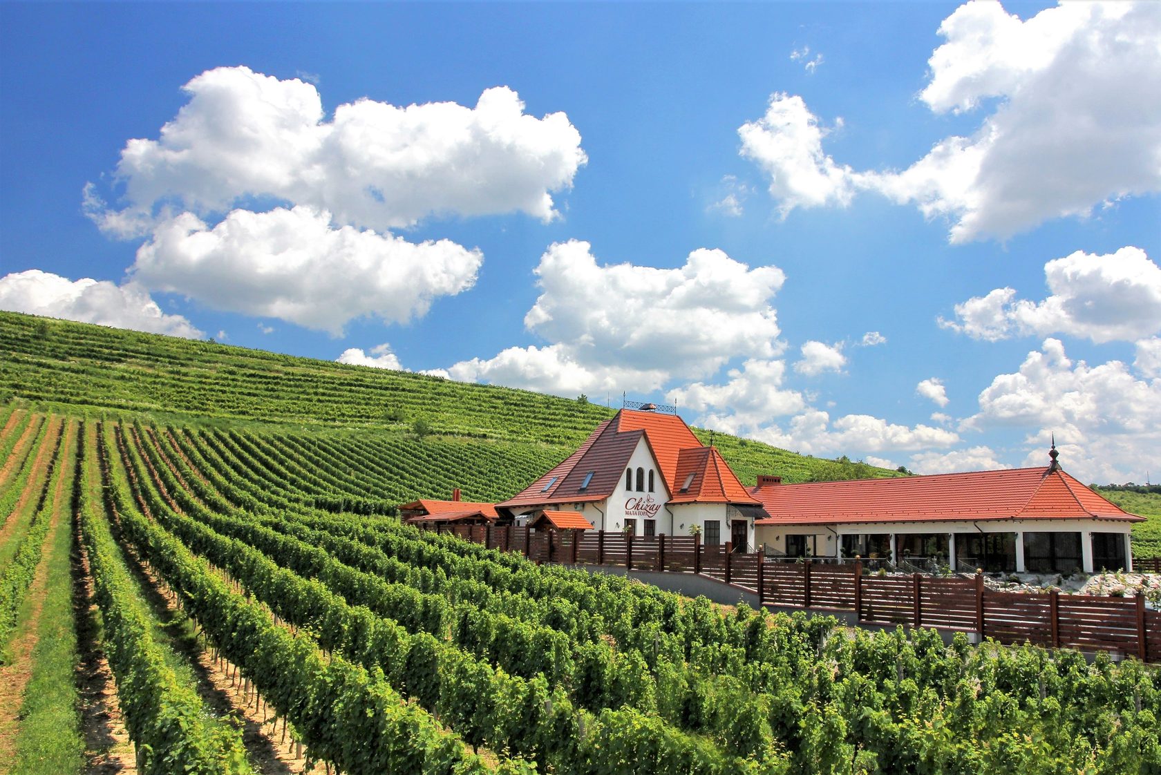
Chateau Chizay, Mala Hora
In the Chizay tract of Berehove is Chateau Chizay.
As early as the 15th century, the country wine estate became a wine supplier to Mukachevo’s Palanok. Winemaking in the region gradually became an increasingly important branch of the economy, and wines went beyond Austria-Hungary and became known throughout Europe. This continued until the 19th century when the phylloxera pest epidemic, then world wars and the Soviet period changed the nature of winemaking in the region. After the anti-alcohol campaign of the 80s and the uprooting of vineyards, winemaking in the region experienced a crisis period.
Chizay became one of those who began to restore the culture in the region. In total, more than a million seedlings of 14 grape varieties grow on 272 hectares.
On the estate’s territory, you can take a walk, have a photo session, get acquainted in detail with the museum of winemaking, and, of course, taste and buy wine.
By the way, if you look carefully, you can find a mini-sculpture dedicated to the Salt Trade Route, which once ran through Transcarpathia, near the entrance. Since there were few other spices, and they were brought from distant countries, salt was highly valued. It also helped to keep products edible for much longer. It’s no wonder that entire villages were founded around salt mining and castles were built.
If you want to complement the wine tasting with delicious dishes, then on Muzhaiska Street, right in the middle of the vineyards, is the hotel and restaurant complex “Mala Hora Chizay”. Thanks to its location and coziness with an incredible view of the vineyards, it quickly became popular among residents and guests of the region. Especially before sunset.
Choma
The first written mentions of the village of Choma date back to 1211, with additional references in 1327. The village got its name from the Choma River. Initially, it belonged to Mihály Buchui, who died without an heir.
In 1327, the Hungarian king Charles Robert granted the village to the ispán (county head) of the Bereg County. In the early 15th century, a third of the surrounding lands was gifted to the town of Beregszász, now known as Berehove. Later, the village belonged to the Szentiványi, Kajdi, and Károlyi families, who also owned neighboring villages.
Interestingly, this area was home to some of the earliest settlements of the ancient Hungarians. The first excavations were carried out in the 19th century. The renowned local historian Tivadar Lehoczky described the findings, which included burial mounds between the villages of Hecha and Choma, and their contents, particularly tools. The artifacts from these excavations are now stored in the Hungarian Museum in Budapest. In 1986, 26 traditional 9th-century graves were discovered. Notably, these burials included horses, weapons, and ornaments. In the 1990s, another 78 such graves were uncovered, and in 2003, the remains of a nearby settlement were found.
For this reason, the main highlight of the village is the Memorial Park of Ancient Hungarians on the outskirts of Choma, where a permanent exhibition tells the story of the distant past of the Hungarian people. Here, you can find sculptures of the Hungarian leader Árpád and King Saint Stephen.
Another unique feature of the village is its Christmas caroling tradition, which has its own local variations and can only be found here. The local “Bethlehem” combines a live nativity scene with puppetry, where the characters have puppet “doubles.” The group includes an angel, two old shepherds, two young shepherds, and King Herod. The old shepherds wear leather masks, which they use to scare people during the performance. King Herod, dressed entirely in black with a soot-smeared face, also serves as the puppeteer. The puppet show takes place in the Nativity scene, where the infant Jesus is located in the right corner. This theatrical performance is a “pocket” of folk traditions characteristic of Greek Catholic villages within the Reformed and Roman Catholic environments, which sets Choma apart from neighboring settlements.
Stakhovsky
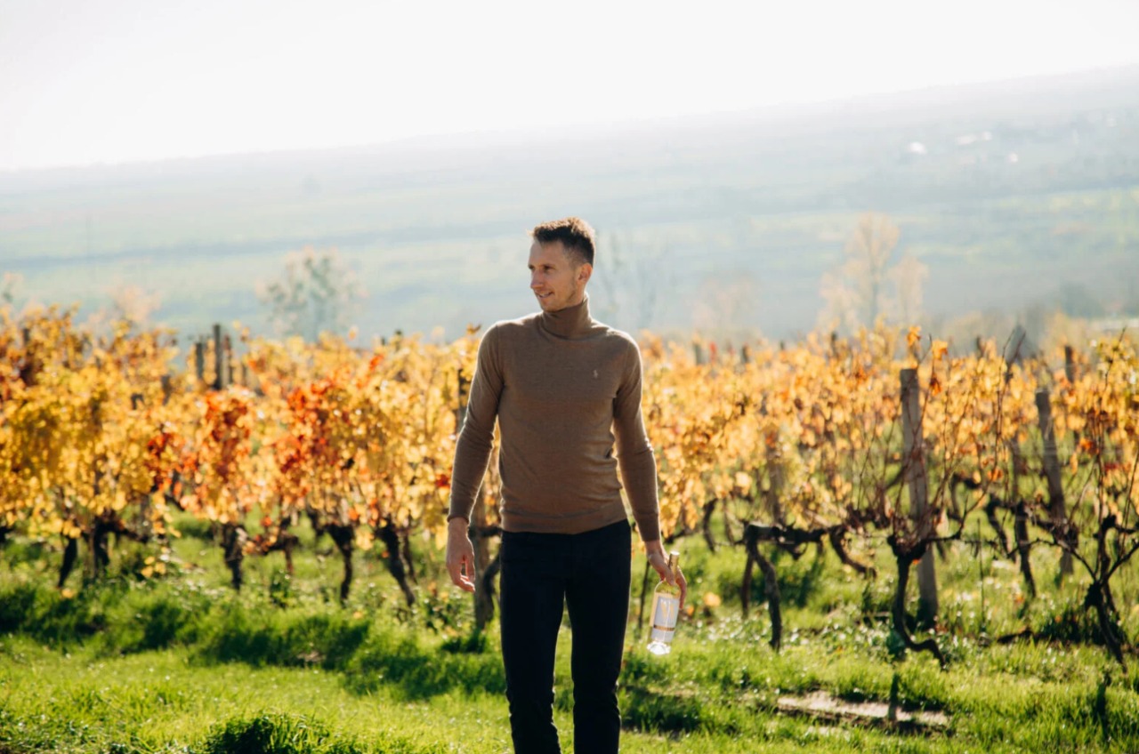
In the village of Muzhievo, it’s worth making another stop. On 5 Fenyvesi Street, you can visit a charming winery and taste the exceptional wines from the “Stakhovsky Wines” vineyards. Serhiy Stakhovsky is not only a legendary Ukrainian tennis player and defender of our country but also a passionate winemaker who has been engaged in this craft since 2015.
Stakhovsky became interested in winemaking after working for a long time in France, specifically in Bordeaux. The craft captured his attention, and he decided to develop it back home in Ukraine. The renowned tennis player leased 20 hectares of land from the Kotnar winery (which you can also visit in Muzhievo) and began cultivating Merlot, Saperavi, and Traminer Pink. He harvested his first crop after three years. The foundation of his concept is the production of high-quality wines, which is why he chose the promising terroir of Zakarpattia.
The vineyard primarily grows Saperavi, Merlot, Traminer, and Cabernet. The first harvest was collected in 2018, and the wines are aged in French barrels from the Bordeaux region. Stakhovsky’s greatest pride is the 2018 Saperavi vintage.
Мужієве
A settlement on the territory of modern Muzhieve was first mentioned in the 13th century. However, in the 17th century, the village was almost completely destroyed and devastated by the Polish army, so the inhabitants were forced to build a new settlement. The ruins of the old Gothic church of St. John the Baptist, which stand in the middle of a field at the entrance to the village, remind us of those times. Now, on the hill above Muzhieve stands a Reformed church, which is located at 7 Vuzka Street. It also has clearly expressed Gothic features. Nearby is a wooden two-tiered bell tower, which has complemented the church since the 17th century.
Muzhieve has long been famous for its winemaking tradition. Wine is made here in almost every yard, so at the kapura (that is, near the gates) you can see local sellers throughout the summer. At 2 Vuzka Street, you can visit the cellar of winemaker Istvan Beretski and taste regional wines.
Interestingly, the village was also a famous mining site. In the vicinity, they extracted both stone, from which millstones were made, and kaolin. But the village became famous for its gold ore reserves – the largest in Ukraine.
Bene
The next stop is the village of Bene, located on the right bank of the Borzhava River. The settlement played an important role in the region. Most likely, it was initially inhabited by foresters. The village has been owned by the church, several local families, and even held the status of a town in the 16th century, which granted certain privileges.
Unfortunately, like most settlements in the region, it suffered from Tatar invasions in the 16th century, and in 1657, Prince Lubomirski took revenge on the owner of Palanok Castle, György II Rákóczi, for his claims to the Polish throne and completely burned down the surrounding settlements.
The oldest monument is a church from 1458, which today belongs to the Reformed Church.
In the very center of the village, there are wooden sculptures of the Seven Magyar chieftains – leaders who brought the ancient Hungarian tribes to the territory of modern Hungary at the end of the 9th century.
Of course, good wine can be found in the village. Many guests visit the wine cellars of Ursta, Varga, and Paraska, which are located on Ferenc Rákóczi II Street.
By the way, they say that the prince, the owner of Mukachevo Castle, loved to rest in the vicinity of the village, and treasures of the Kuruc – Hungarian rebels – are hidden everywhere in the surroundings. Interestingly, the names of the hills on the northeastern outskirts of the village – Kisvar and Nagyvar – literally translate as small and large fortress. So, perhaps, there was once a castle here.
Chetfalva
Another stop awaits us on the right bank of the Tisza River, to the right of the road to Vynohradiv, where the village of Chetfalva is located. According to historians, the name comes from the surname of the village founders – the Chet family.
The former Catholic, now Reformed church is a true gem of the region. The sharp-angled tower on 91 Petőfi Street can be seen from afar. Interestingly, the 14th-century temple is built in such a way that the sun illuminates the nave and altar all day, from sunrise to sunset. Inside, there is a unique coffered ceiling made by Ferenc Lándor Asztalos. On it, like on a chessboard, light and dark square wooden coffers alternate, which were painted by the artist. The bell tower of the temple with four spire towers is one of the highest structures of this type in Transcarpathia.
Another interesting church, though modern, immediately catches the eye. It was designed by the famous Hungarian architect Imre Makovecz, and the temple is used by both the Greek and Roman Catholic communities of the village. For this purpose, an interesting iconostasis in the form of a folding screen was created in the temple, which is open during the Greek Catholic service and closed during the Roman Catholic service.
Vylok
Our next stop is the village of Vylok, located near the Ukrainian-Hungarian border on the right bank of the Tisza River.
The first written mention of the settlement dates back to 1304. The first settlers lived on an island in the Tisza River, which was named after Saint Helena.
In the center of the village is the Greek Catholic Church, built in 1806 in the Classical style. Interestingly, the church tower also served as a lookout tower for local firefighters.
At 2 Thomas Esze Square stands the former Salt House. Since Vylok had been a trading hub for centuries, various goods, including salt, wine, and timber, were actively transported through it.
A highlight of Holovna Street is the Roman Catholic Church, built in honor of Saint Helena in the 18th century. Nearby, there is a chapel dedicated to Saint John of Nepomuk.
Of course, there is also a Reformed church in the village, built in the 19th century, which adorns 67 Rakoczi Street. Interestingly, the foundation of the building was a former salt warehouse. Rakoczi Street leads directly to the Hungarian border, and the village operates the international border crossing “Vylok-Tiszabech.”
In July 1703, near the village, Ferenc Rákóczi II and his Kuruc rebels clashed with the army of the Austrian emperor and won their first victory. In 1908, at the site of the battle, an 18-meter monument was erected, featuring a national symbol—a Turul bird holding a sword in its beak. According to legend, this bird warned Rákóczi about the enemy’s approach and saved him during the heat of battle by bringing him back his sword when he had lost it. The enemy, it’s said, was so frightened that they fled in all directions and became stuck in the swamps, where they perished. The original Turul stands on the grounds of Uzhhorod Castle, but in 1989, it was restored in Vylok as well.
Shalanky
In 14th century sources, a settlement near the Borzhava River is first mentioned. It is said that Prince Ferenc Rákóczi II, while staying here, was very thirsty. But there was no clean water around as the area was heavily swampy, and supplies were almost exhausted. Then Rákóczi sent his subjects to search for water. The prince’s chancellor, Kelemen Mikes, managed to find crystal clear and tasty water. Since then, locals have called the hill near the spring Mikes’s Hill, and a well was made at the spring site. It was in Shalanky that the last meeting of the general assembly of rebels led by Ferenc Rákóczi II took place. According to legend, the state assembly meetings were held on the triangular hill of Hemlivts. On the hill, you can still see a round stone on which the prince wrote an address to the people. Once there was the Borkovtsi Palace here, but in 1717 it was destroyed by the Tatar horde. Now only the wine cellar remains from the palace, located at 15 Fabrychna Street. So it’s no surprise that a memorial park was established on the village territory where you can find monuments to Rákóczi, Mikes, and the first Hungarian king – Saint Stephen, and a number of memorials. At 110 Holovna Street, you can find a Gothic Reformed Church, which once belonged to the Roman Catholic community and was built in the 14th century. On the same street, but at number 40, there is a Greek Catholic church from the 19th century, consecrated in honor of Archangel Michael. The village was also famous for its cooperage workshops. Oak barrels were made here, which went far beyond the region. The raw material was oak from the Great Forest. Interestingly, the villagers also made two-chamber barrels, which could hold two drinks simultaneously. And today, this tradition is preserved in Shalanky.
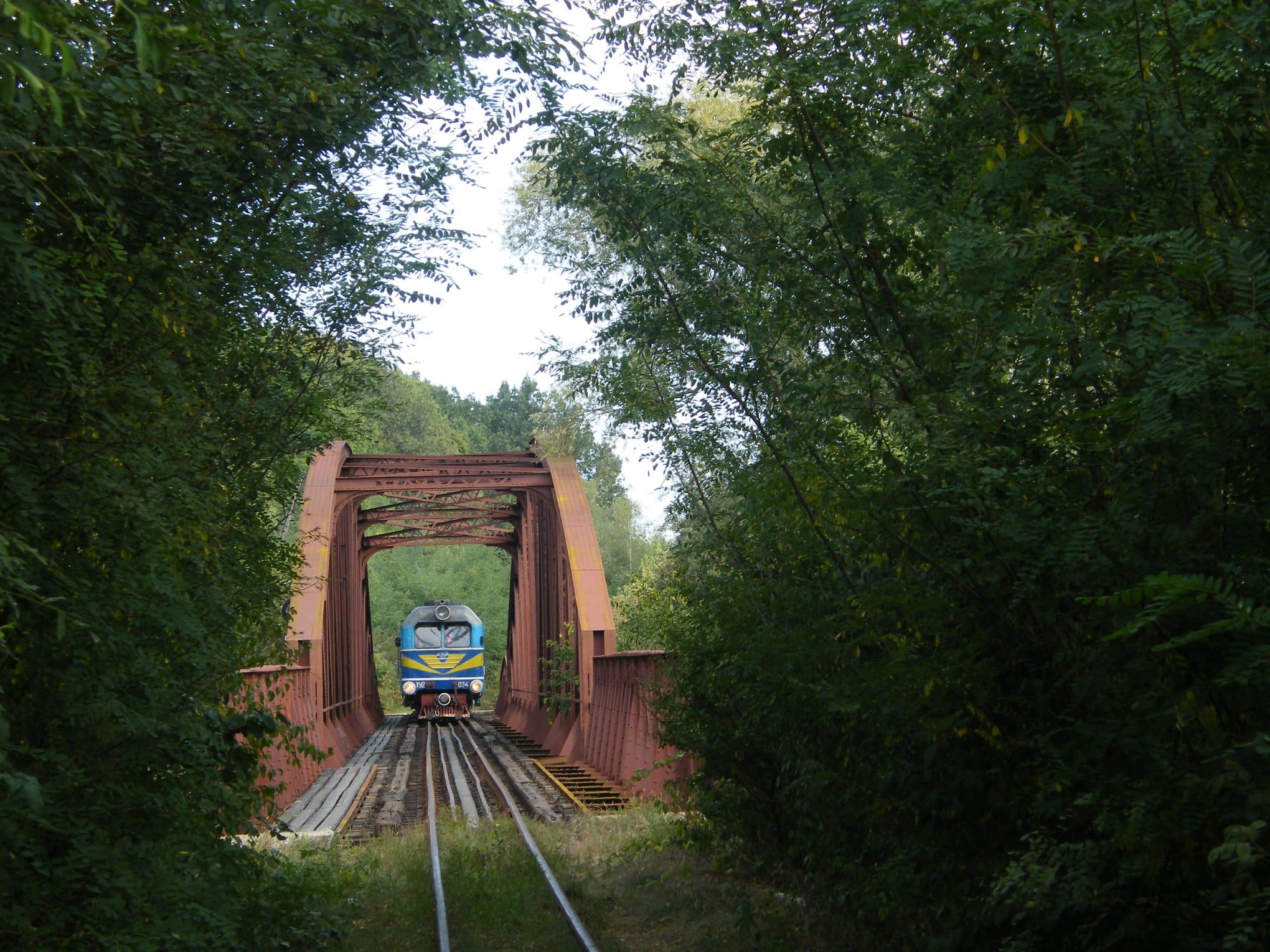
Borzhava Narrow Gauge Railway: Antsia Kushnytska
We are heading to the next stop on our route – one of the until recently working narrow-gauge railways in Ukraine, called Borzhava. Although it is also known among the people as “Antsia Kushnytska”. The name appeared when the narrow-gauge railway went to the village of Kushnytsia, where more than one Anna lived. In fact, the narrow-gauge railway can be seen traveling through several villages of Berehove and Vynohradiv districts. In particular, in Shalanky or Khmilnyk. Its length is 123 km. Archives show that attempts to build a railway in the Borzhava River valley were made as early as the 19th century. However, the actual “birth” of the narrow-gauge railway can be considered February 1904, when money for construction appeared. The importance of Antsia in the region can hardly be overestimated, as it was perhaps the most important transport connection in the region. Although it mainly transported timber, there was also very active labor migration of the population. Thanks to the narrow-gauge railway, people from Verkhovyna could get to the fair in 3 hours instead of a day and a half. The official start of its activity is 1908. Initially, it was privately owned and was a joint-stock company. During the USSR times, the Borzhava narrow-gauge railway was also used to transport workers from the Irshava district. It now transported not only timber but also materials for construction companies, furniture factories, machine-building plants, etc. The decline of “Antsia Kushnytska” activity falls on the 90s, when with the collapse of the USSR trade connections were lost, the Ukrainian railway began to operate independently, and the Borzhava narrow-gauge railway began to be perceived as a relic of the past. Later, with the help of concerned activists, the Borzhava narrow-gauge railway became an interesting element of local tourism, which enthusiastically arranged excursion trips from time to time. If you walk along the tracks from Khmilnyk to Shalanky, you will encounter abandoned old Polish “Pafawag” wagons from 1960 that were still “running” on the tracks until 2010 and pass through an old railway bridge from 1884.
Vynohradiv
Vynohradiv was the main settlement of the region. Until recently, it was also a district center, but after decentralization, it became part of the Berehove district. It’s one of the oldest settlements in the smallest comitatus (county) of the Hungarian Kingdom – Ugocsa. Interestingly, from its foundation, it had royal privileges, and the settlement was most likely inhabited by royal winemakers.
Let’s start our walk from 51 Myru Street, where the local school is located, but in its time, this was the county administration building. Built in neo-baroque style in the late 19th century. Nearby is a garden with monuments to famous Hungarians: Baron Zsigmond Perényi, who owned the city, and composer Béla Bartók, who once made an expedition to preserve folk music, traveled through Transcarpathia, and collected folk art.
We continue to the square that connects Myru and Shevchenko streets. In the middle of the square is an octagonal decorative fountain. Information about the city is located on the edges. In the central part, there’s a statue of a young girl treading grapes barefoot – an ancient winemaking tradition now observed at festivals.
Continuing along Myru Street, we first see the 19th-century Reformed Church, and then we come to one of the most significant medieval monuments of Transcarpathia: at 2 Myru Street is the Roman Catholic church of Vynohradiv. The church dates back to the 13th century, although it was expanded and partially rebuilt over time. Inside the church is an organ by Sándor Országh and his son, dating from the 19th century, which is worth listening to if possible.
Directly opposite the church is the Franciscan monastery and church. The monastery was built in the 18th century, and in the 19th century, a church appeared nearby. In front of the monastery building, in 2013, a sculpture of St. Francis of Assisi with a friar holding a grape vine was installed in a small chapel. The Franciscan monks received their first monastery in the city thanks to the Perényi family, who owned it at the time.
Further on, Shevchenko and Myru streets join again in the park. At 4 Shevchenko Street is a museum where you can learn more about the history of Ugocsa County.
Nearby is the building of the former Vynohradiv Royal Civic School, which still houses an educational institution, and to the left is the synagogue. Before World War II, the Jewish community of the city made up almost half of the population. They were the most enthusiastic merchants and artisans.
In the park area on Myru Square, you can rest and admire various monuments. There’s a statue of a winemaker squeezing grapes, a bust of Taras Shevchenko, and even a small mini-sculpture dedicated to the aforementioned Béla Bartók.
Buffalo Farm "Carpathian Buffalo"
The next stop awaits us on Pershotravneva Street in Vynohradiv. This is the unique “Carpathian Buffalo” farm. It’s unique not only because it promotes the appearance of delicious eco-products, which can be tasted and purchased here, but primarily because its activities are aimed at preserving and reproducing the population of the Carpathian buffalo.
It’s quite simple. Unfortunately, human activity directly affects the ecology and natural environment in which it lives. Due to deforestation in the Carpathians, the growth of cities and villages, industry, and land reclamation, many rare animal species have been pushed to the brink of extinction. The decrease in the Carpathian buffalo population is also influenced by the fact that not everyone today can and wants to engage in private agriculture.
These majestic and calm animals were previously used in every household. Buffaloes were used as powerful labor, and buffalo milk was used to make cheese and sour cream. The animal’s milk is very beneficial and easily digestible. Here you can not only admire the majestic and cute buffaloes but also familiarize yourself with the process of making dairy products. Most importantly, your visit will support the population of an endangered species.
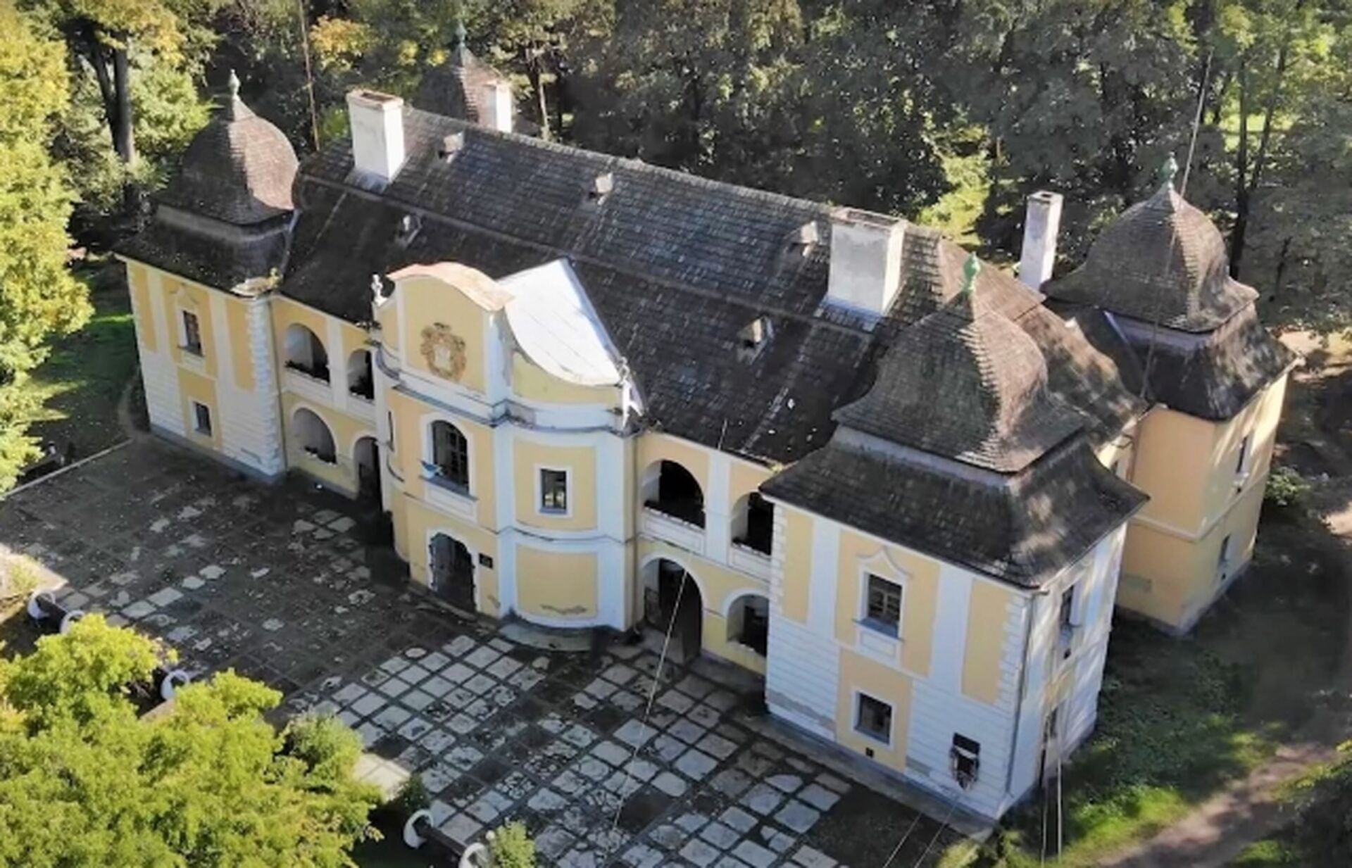
Kankiv Castle and Perényi Palace
Continuing our walk through Vynohradiv, we move towards Chorna Hora (Black Mountain). At 10 Kopanska Street, we see the baroque palace of the Perényi family built in the 16th century. Initially, the building was one-story, but in the 17th century, there was a need for expansion, so a second floor was added. The family coat of arms will greet you at the entrance. This family has been known since the 13th century, and family members had significant estates in the counties of Ung, Bereg, Ugocsa, and Maramures, that is, throughout present-day Transcarpathia and beyond.
In the 14th century, Hungarian King Sigismund I gifted Sevliush (old name of Vynohradiv) to Baron Peter Perényi for his help in the fight against the Turks.
Among the famous representatives of the family, Zsigmond Perényi stands out. He was a prominent Hungarian figure and politician, one of the fighters for the rights of the Hungarian people. During the war for Hungarian independence in 1848-1849, he was elected president of the upper house of the Hungarian parliament, and in April 1849, he signed a declaration for Hungary’s independence from the Habsburgs. In October of the same year, after the suppression of the uprising, the Austrians executed the baron.
They say that the last time he was at home, he asked the servants not to close the large iron gates until he returned home. The wrought iron gates in front of the palace entrance still preserve this tragic history.
Today, the building is used by the education department. Of the former garden of over 12 hectares, unfortunately, only the park area around the house remains.
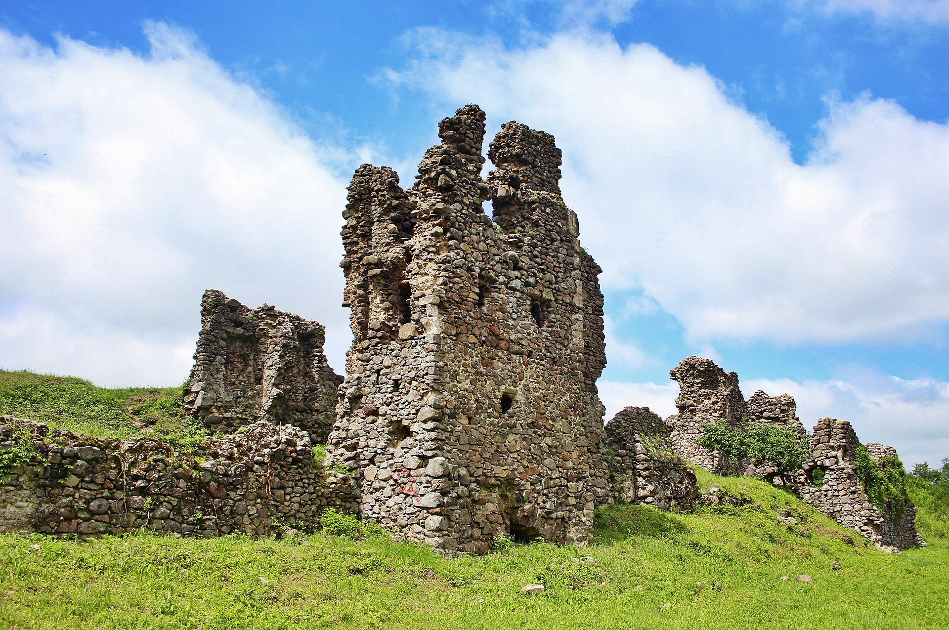
Continuing our tour, we’ll visit Kankiv Castle, which is the pearl of Vynohradiv’s historical heritage. To do this, we move from Kopanska Street to the path leading to Chorna Hora. Only ruins remain of the fortress’s former grandeur. This castle performed an important function – it controlled the trade route along the right bank of the Tisza River and the bridge across it. Earlier, the castle bore the name of the county – Ugocsa, but when it fell into the hands of Franciscan monks who wore upper clothes made of wool called “kanko,” it received the name that has survived to this day.
A wooden castle already stood on this site in the 13th century and is first mentioned as the property of the Borsa family. However, after their rebellion against King Charles Robert, it was destroyed, and the stone castle was rebuilt by the Perényi family in the 15th century.
The fortress was rectangular, protected by bastions and a watchtower.
At first, it was used by monks, but in the 16th century, the Perényis converted to Protestantism and expelled the Franciscans, fortifying and rebuilding it into a knight’s castle. When the family supported the Transylvanian prince John Sigismund and went against King Ferdinand I, he ordered his soldiers to occupy the castle and destroy it. So it has stood in ruins since 1558.
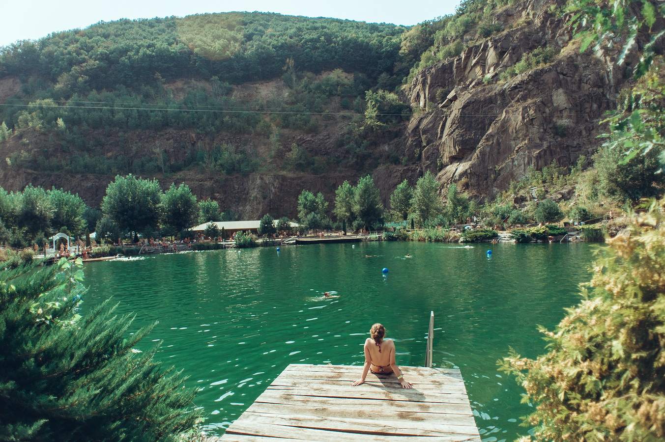
Chorna Hora (Black Mountain)
Між Виноградовом та селом Мала Копаня розташовано ботанічний заказник “Чорна гора”, що є частиною Карпатського біосферного заповідника та популярний серед тих, хто любить легкі піші прогулянки лісистою місцевістю.
У межах заказника розташована однойменна гора, вулканічний останець — Чорна Гора (568 м). Гора належить до так званих острівних гір, тобто вона не є частиною жодного гірського хребта та з трьох боків оточена Закарпатською низовиною, і лише її північні схили переходять у пологе горбкувате підвищення, яке простягаються на північний схід до масиву Тупий. Уздовж східних схилів гори протікає річка Тиса, яка в декількох місцях утворила високі скелясті урвища.
На вулканічних породах гори сформувалися буроземні ґрунти різної родючості. Серед дерев тут росте переважно дуб та бук. Крім того, тут збереглися єдині в Україні осередки ясена білоцвітого. Загалом, на території заказника зростає близько 400 видів вищих рослин.
Біля підніжжя гори знаходиться курортна зона урочища Виннички та готельно-розважальний комплекс “Чорна гора”. Озеро, що тут розташоване є популярним місцем відпочинку.
Цікаво, що крім любителів природи Чорна гора привертає і любителів містики та авантюристів: кажуть тут здавна збираються відьми, а в печерах гори заховані скарби як тамплієрів, так і місцевих розбійників-опришків.
Velyka and Mala Kopanya
You’ve probably already heard about our next stop.
The history of these two neighboring villages is a story of human struggle primarily against large, difficult-to-traverse forests. Settlers, having chosen a piece of forest suitable for agricultural production, cut down trees. The cleared area was called a “pasika” (apiary). Dried tree trunks were taken to the homestead, and the rest were burned.
The area cleared of forest was called “spal” or “pohar.” It was dug up, cleared of stumps and roots, and became suitable for agricultural use, then called “kopanya.” This is where Velyka and Mala Kopanya get their names.
The villages are first mentioned in the 15th century. An interesting legend about the foundation of the village has survived to our time: not far from where Velyka Kopanya is now, a feudal lord lived on a high mountain. He had a very beautiful daughter. The girl fell in love with a simple village boy when her father wanted to marry her off to someone with a title. He said he would marry her to whoever she wanted, but only if she dug up the large mountain in front of their estate with her bare hands. They say she dug up the whole mountain. The father was angry but had to give his daughter to the commoner. And they settled right where the girl had dug the mountain. That’s how the village appeared.
However, Kopanya became famous due to interesting statistics. Here, every second family has twins, so the village was included in the Book of Records of Ukraine and is called the Ukrainian capital of twins. The most twins were born in the 1990s, although twins began appearing in the village as early as 1941. The record was set in 2004 when in June the population increased by three pairs of twins.
Villagers associate this number of twins with the miraculous water of one spring. Behind the Kopansky ridge, geologists discovered a huge underground lake that feeds local springs. Year after year, twins are born in the village, and the spring itself has become popular among those who want to have twins.
Korolevo
The next stop awaits on the left bank of the Tisza. 9 km from Vynohradiv is a unique settlement – Korolevo. The population here is no less than ten thousand, of which over 93% are Ukrainians.
The first mention dates back to 1262. It got its name being the center of royal forestry possessions between the Avash and Chorna mountains. Accordingly, a hunting house was built here, where Hungarian King Stephen V Arpad came to hunt.
To the northwest of Korolevo, you can see the famous “Khust Gates” — a unique natural phenomenon. Their width is about 3 kilometers. It is from here that the plain begins, which after 100 km turns into the Great Hungarian Plain. Here, on the top of the mountain, remains of a Neanderthal settlement were found. This is the oldest human site in Central and Eastern Europe — the Korolevo site, which today has been destroyed by a local gravel plant. Stone tools 1.4 million years old were found in the village, which turned out to be the oldest in Europe. These are knives, scrapers, chopping tools, spear tips made of andesite and flint. And in the Kruti Lany tract, on the southern outskirts of the village, an early Iron Age settlement was discovered, where bronze objects over 2,500 years old are found.
What else will surprise you in this royal settlement? It was here that the Korolevo Gospel was written — a manuscript from 1401, written on 176 sheets, decorated with various miniatures, which is considered one of the oldest books written in Transcarpathia that has survived to our time. The book is a valuable source of history, a remarkable monument of manuscript art and Ukrainian writing. The original is kept in the Transcarpathian Museum of Local Lore.
And of course, the Korolevo Castle where the book was written. But we’ll talk about that separately.
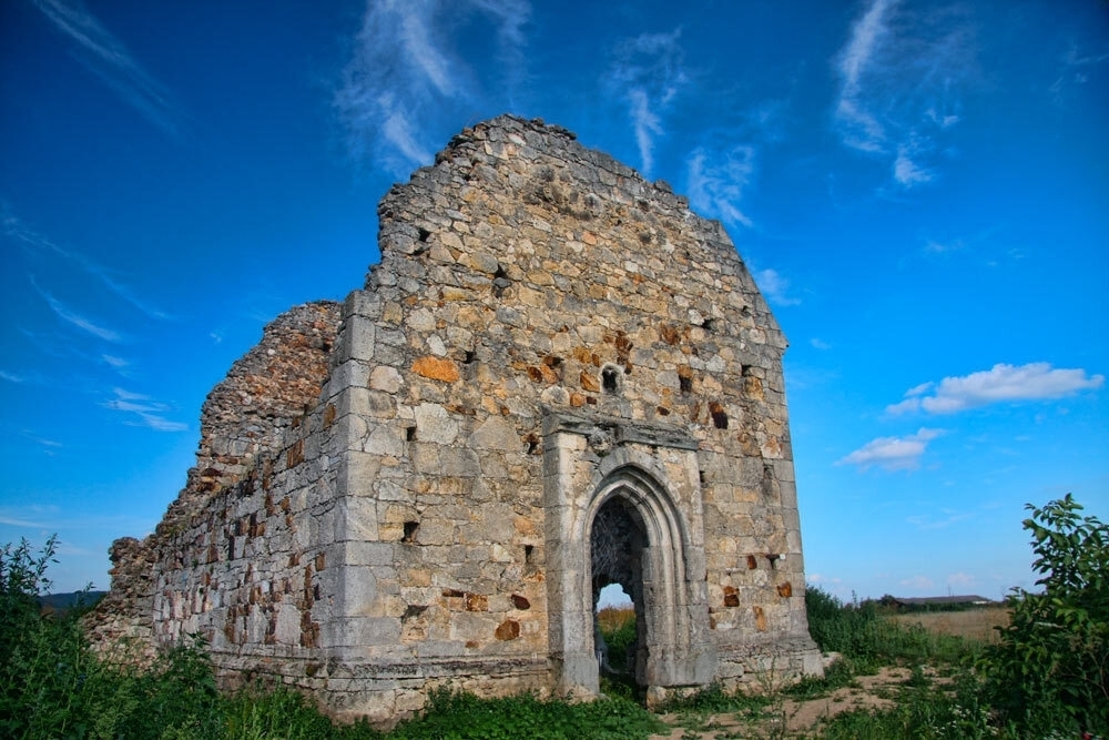
Nyalab Castle
As we’ve already mentioned, the outskirts of Korolevo were a favorite place for Hungarian King Stephen V to hunt wild animals: boars, bears, and bison. To have a place to rest, a hunting house was already being built in 1262.
Later, in 1272-1315, stone fortifications were built and the castle served as a customs and guard post on the salt route from Maramures.
The castle was located on a hill 52 meters high at a distance of 300 meters from the Tisza River. The central part of the fortress was oval in shape and was additionally protected by outer walls.
The interesting name of the castle, according to legend, comes from the name of the Hungarian robber Nyalab, who at the end of the 13th century captured the castle and owned it for some time. A kind of Robin Hood who robbed the rich but was noble. However, there is another version of the origin of the name associated with the translation of the word Nyalab, which translates as “bundle,” as some part of the goods had to be left here as a tax for passing the post and using the road.
Since the Royal Nyalab Castle served as the king’s residence, important cultural events also took place at the court. We already know about the Korolevo Gospel that was rewritten here, but in addition, Bible translations were carried out here and the letters of the Apostle Paul were first translated into Hungarian. The Hungarian lutenist and author of ballads Peter Selmes Ilosvai created almost all of his vocal epics within the walls of Nyalab Castle. Therefore, although with the development of Khust Castle in the 14th century the castle gradually lost its leading defensive role, its importance for the region still remained significant.
In 1405, the king granted the request of Baron Peter Pereni, already known to us, to transfer Nyalab to his ownership. At that time, Pereni had already owned the neighboring Vynohradiv Castle for 6 years and was helping the king in the fight against pretenders to the Hungarian throne. Nyalab became the main residence of the Pereni family.
In the second half of the 15th century, the castle’s fortifications were reconstructed, which, according to some historians, involved the famous Italian architect Aristotele Fioravanti. At that time, a chapel was built, in which the King of Hungary Vladislaus II ordered himself to be buried.
In 1661, the Turks looted Korolevo. However, despite a significant numerical advantage, they did not dare to storm the castle itself. Unfortunately, its history did not last much longer after that…
In 1672, King Leopold ordered the castle to be blown up, probably fearing the growing influence of local magnates. Subsequently, the structure was not restored and soon only the ruins of the castle towered on the hill.
In the 19th century, the castle became a popular location for archaeological research.
Veretsia and the Rock of Maria Theresa
Now we head to Veretsia.
The first mention of the village dates back to 1355, associated with the granting of a royal charter to Korolevo, Sasovo, Chornotysovo, and Veretsia. Most likely, the main population of the village consisted of laborers from Nyalab Castle, which towers above the settlement. The main crafts in the village were weaving and forestry. Of course, there is also an 18th-century church here. But the village is most famous because it once housed the first beacon in Transcarpathia.
You see, from ancient times, brave lumberjacks, known as bokorash, used to float their rafts (bokory) all the way to the mouth of the Danube. This dangerous job was performed only by those bold enough to master the treacherous mountain rivers, which were full of sharp turns and rapids. Not far from the village rises a cliff, locally known as “Kyp.” The Tisza River would crash into it with immense force, creating a whirlpool. Unfortunately, many bokorash met their fate here while rafting salt and timber. When the relatives of the deceased asked to be shown the place of the tragedy, they were directed to the river, with people saying, “In the whirlpool!” Hence, they say, the name of the village, Veretsia, came from the word “whirlpool” (Ukrainian: “vir”).
The rock that caused the bokorash accidents became known as “Maria Theresa’s Rock,” and here’s the legend behind it: When the water level in the Tisza rose due to rain, the bokorash couldn’t see the sharp outcrop of the cliff and would perish. This is what happened to Maria Theresa’s husband. They lived in Khust, and after his death, she moved to Veretsia and settled on the Kyp rock. She personally carved out a cave in the rock, made a table and bed out of stone, and when a storm would rise on the river, she lit a torch on a long stick, holding on to a tree with one hand and signaling to the bokorash with the other. The bokorash, seeing the light from afar, would steer their rafts to the middle of the river, safely bypassing the rock. Today, many people visit this cliff, and even the table, bed, and some other items from that time have been preserved.
Botar
We cannot overlook the small village of Botar. The first mentions of it date back to the 13th century.
The majority of the village’s population is Greek Catholic, but on Holovna Street, you can find both Greek Catholic and Reformed churches.
The highlight of the village is the Tigesh farm, known for its juices, syrups, and other products. However, the main attraction is the Lekvarium, a museum and tasting hall for lekvar, located at 2 Petefi Street.
Lekvar is a traditional Transcarpathian plum jam made from Hungarian or Bystrytsia plums (Bystrytsia plums), whose fruits can reach the size of a kiwi, or from the local Nemtudom variety. Depending on the type of plum, the lekvar has a more pronounced sweet or sour taste. It has been known since the early 19th century, related to the spread of fruit orchards in peasant households in the region. Lekvar played a significant role in everyday life because plums grew in every yard and were very popular in cooking. It was eaten as a separate product, dessert, and used in preparing various dishes such as home-made sausages (piknytsia), gombovtsi, shutyminy (local delicacies), and sauces for meat dishes. Traditional lekvar contains no added sugar and has a very thick consistency. Since 2022, it has been recognized as part of Ukraine’s intangible cultural heritage.
The name comes from the Hungarian “lekvár,” meaning “jam” or “preserve” made from various fruits. Nowadays, in addition to the traditional type, you can also try apricot, raspberry, strawberry, blueberry, chokeberry, and other varieties of lekvar.