
AUDIO GUIDE "Lesser-known and less-visited places in the Khust district"
Greetings, I am your audio guide, and today I want to acquaint you with little-known and little-visited places of the Khust district — very interesting historical, architectural, and natural sites. But it is worth mentioning the main city of the region, once part of ancient Maramureș, located in the Ukrainian section of the Tysa River valley, on its left bank within Zakarpattia. By the way, we will also visit it today, but a bit later.
And now, to your attention – the ancient city of Khust, situated on the bank of the Tysa not far from the point where it receives the waters of one of its main tributaries – the Rika River. The Khustets River, winding around Castle Hill, also joins the Tysa.
The ruins of Khust Castle stand as a silent testament to the historical events that have unfolded in the city. In ancient times, the castle served a crucial defensive and strategic purpose, and it also oversaw trade routes, including the Salt Route. The city of Khust itself is also recognised in Ukrainian history for its part in the nation-building process of Ukraine – in the spring of 1939, during challenging historical times, the city became the capital of Carpatho-Ukraine.
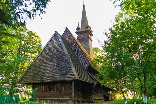
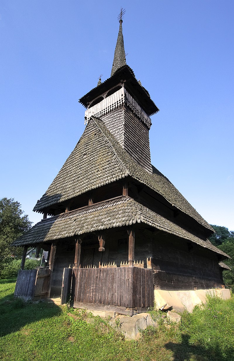
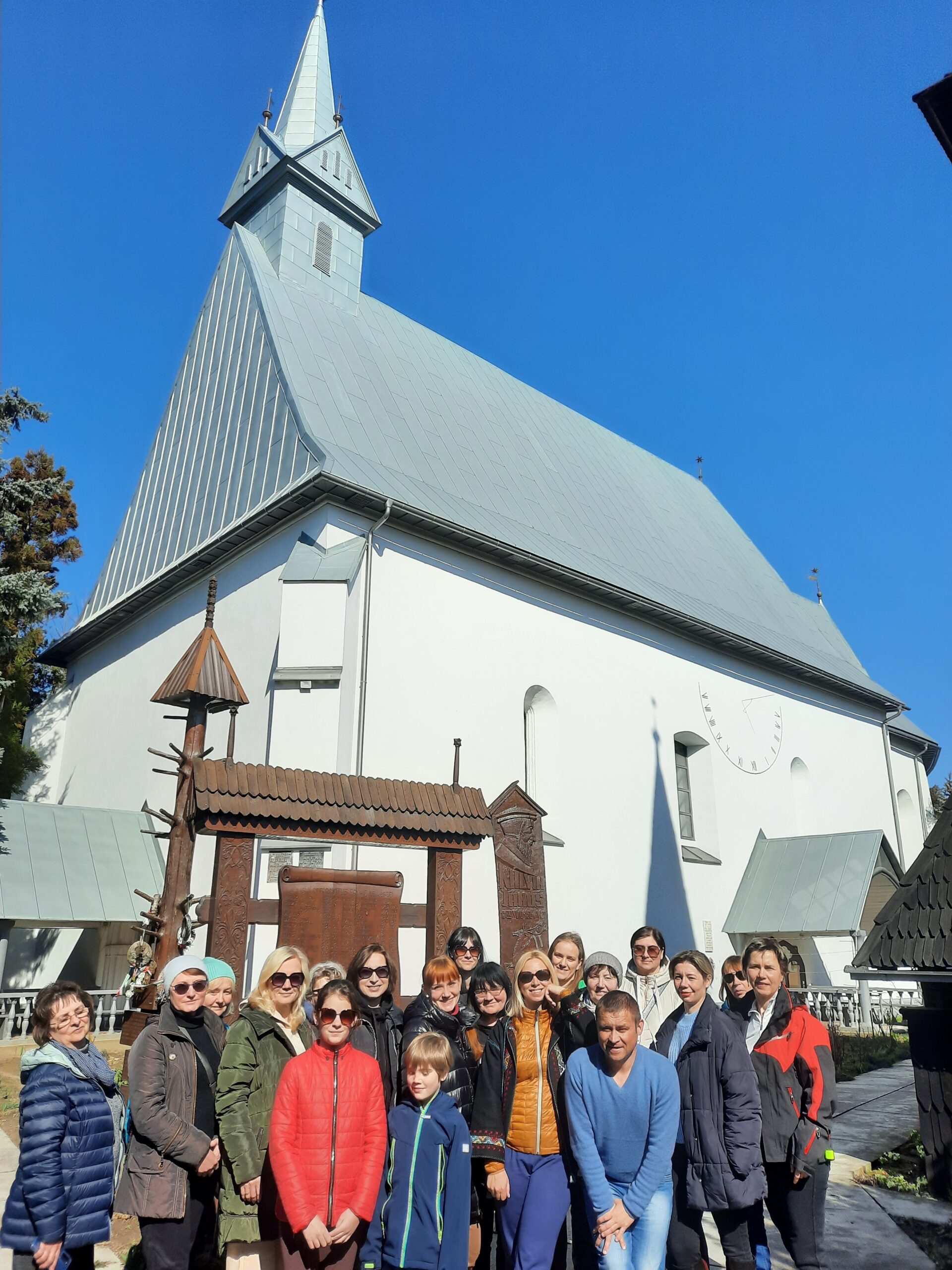
Sokyrnytsia village, Wooden Church of Saint Nicholas
Just 10 kilometres from Khust lies the village of Sokyrnytsia in the Khust district of the Zakarpattia region. More than 4 thousand residents live in the village, over 98 percent of whom are Ukrainians. There is little information about the history of the village’s origin; the first mention dates back to 1389.
The village was established under a law that was in force at the time in the territory of the Kingdom of Hungary, on conquered lands. This law became known as the Vlach Law (Voloske Pravo), just as most settlements in the region emerged during this period. People moved to Maramureș from the overpopulated regions of Wallachia, which were inhabited by cattle breeders. But it wasn't only the Vlachs, the ancestors of modern Romanians, who settled here and took the opportunity to freely settle on land without paying taxes – other peoples, including Ukrainians, did so as well.
That is how one of the numerous Ukrainian villages in the Tysa valley arose — the village of Sokyrnytsia.
As for the origin of the village’s name, there are several interesting legends, all of them connected with an axe. According to tradition, this tool was used to chop down the oak grove where the village eventually appeared, and where, on its main street, the unique wooden St. Nicholas Church — built in a sturdy log-cabin style — and several hundred-year-old oaks still stand today.
The location for the church was not chosen by chance, as the temple is situated on an elevated point of the landscape. You wouldn’t call it a hill, but it is still the highest point in the village.
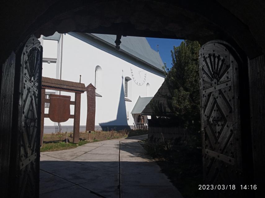
The church boasts an interesting history, having originally been constructed in the Vynohradiv district, in the village of Trosnyk. Consequently, the lower log sections of the church travelled over 50 km. The residents of Sokyrnytsia purchased the church and re-erected it in 1704 on the very spot where it still stands today. In 1770, the church was reconstructed, and a tower with a spired Gothic top, surrounded by four small turrets, was added. At the same time, a framed bell tower made of oak beams was built near the church – and it still serves its purpose.
Entering the temple, we see a closed porch with triangular window openings and an entrance portal; the jamb of the babynets (women's gallery) is framed by three strips of rope ornament\. The interior of the church suffered severe damage during the Soviet period: the church was closed, and the roof rotted and leaked\. The old painting survived only on the pedestals beneath the hanging icons\.
Although a new stone church began to be built nearby in 1990, this wooden church remains the main tourist attraction of Sokyrnytsia village. It stands among the picturesque Tysa valley on the banks of three rivers — the Tysa, Pomiyntsia, and Baylova. A very picturesque area, just like the rest of Zakarpattia.
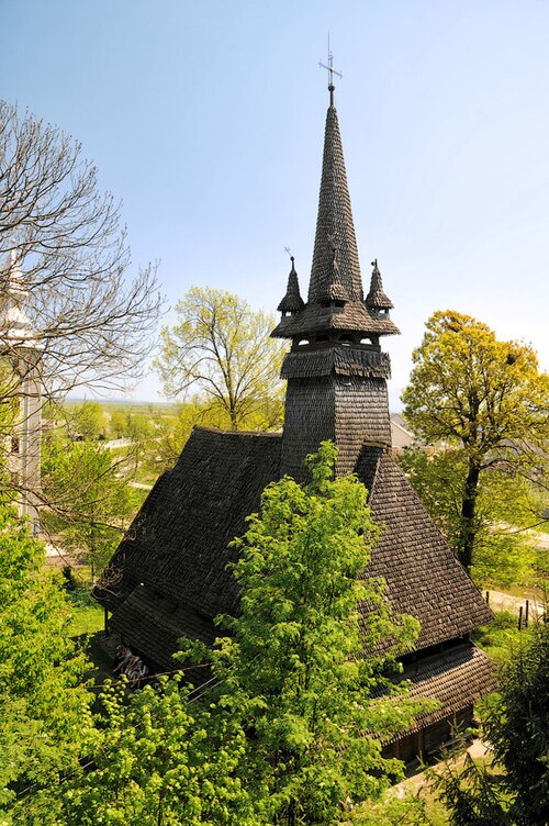
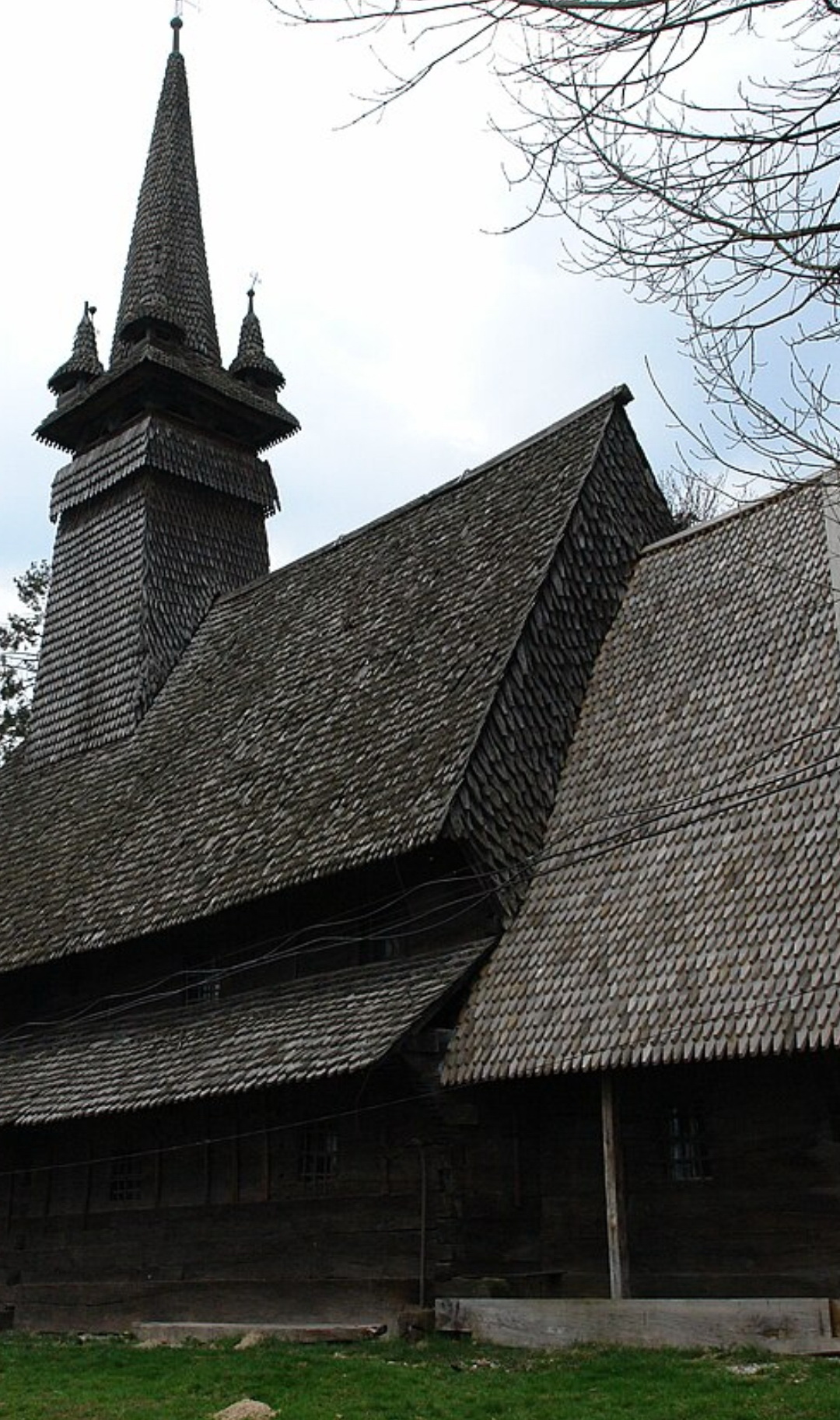
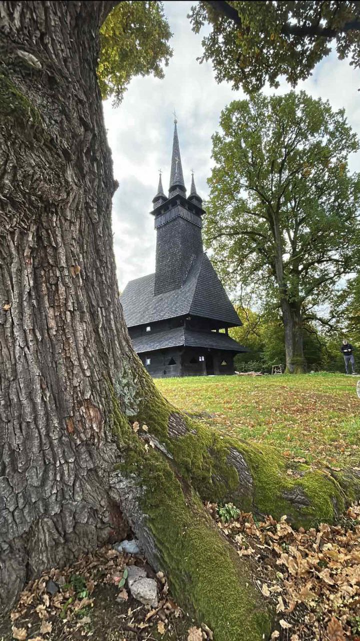
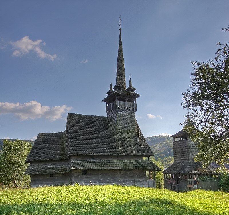
Krainykovo village, Saint Michael's wooden church.
The village of Krainykovo is located very close to Sokyrnytsia today. The main street from one village transitions into the other, with almost no distance left between them. The village's history is linked to its relocation from the Golda tract to its current location, where it was revived "at the outskirts" (po krayu) of the previous village after a plague epidemic. The village was reborn in a new place, where the church, now a significant historical monument, was built. The first mention of the village dates back to 1389.
According to legend, there was once a royal estate in this area, which was surrounded by dense oak forests. On the edge of the forest was a healing spring – a well (krynytsia). It was precisely near this well that the wooden St. Michael’s Church was built between 1666 and 1668. St. Michael’s Church is a brilliant wooden creation, located almost on level ground in a clearing with a slightly raised relief above the village below. Two 600-year-old oaks still grow near the temple. Just a few years ago, there were four of them.
The tall Gothic church, 25 metres high with a spire and 14 metres long, appears very impressive. The side facades are wide oak planks of the log cabin and high slopes of the roofs covered with shingles. The main log structure connects the nave, the babynets (women's gallery), and a closed gallery with triangular openings on the main western facade.
Entering the temple, we see wonderful architectural and artistic details. These include the mighty door jambs of the gallery, decorated with a rope ornament, above which the date of construction is carved. Around the entrance doors are door jambs with ornaments of ancient sun symbols. Many constructive elements testify to extraordinarily professional craftsmanship. The temple belongs to those few in Ukraine that have wall painting on canvas, glued to the smooth walls of the wooden log cabin. The paintings of the 17th–18th centuries suffered severe damage during the Soviet era. Separate icons of the dismantled iconostasis from 1769, created by the painter Yavorsky from the village of Vilok, have survived.
Krainykovo Church, with its 600-year-old oak trees, creates an exceptionally beautiful place and, like a living time machine, transports visitors back to the 17th century.
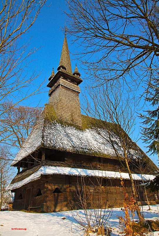
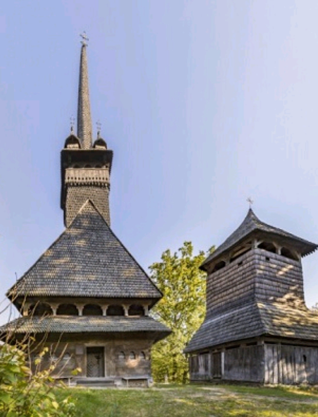
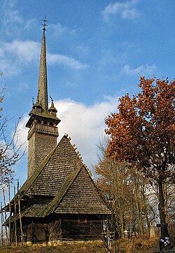
Danylovo village, wooden church of Saint Nicholas.
Just a few kilometres from Krainykovo and we are already in the village of Danylovo, first mentioned in 1390. Prior to this, a large ancient Rus' fortified settlement (11th–13th centuries) had stood here, as evidenced by archaeological finds. Today, the village is home to up to 2,000 residents. The village possesses its own ancient coat of arms, which points to its historical significance.
In the very centre of the village, on a low but quite steep hill, rises one of the most beautiful wooden churches in the Khust district, which also belongs to the wooden masterpieces of Maramureș Gothic. St. Nicholas Church in Danylovo village is the youngest among the district’s wooden churches, built in 1779, and the tallest – 35 metres high. In addition, it is built on a hill, rising upwards and seemingly touching the sky with the tip of its sharp spire. This is where the Gothic of ancient Maramureș manifests itself.
The church was completely re-roofed with new wooden shingles in 2011, giving it a fresher appearance. Inside the temple, a wooden openwork arcade separates the babynets (women's gallery) with a flat ceiling from the nave and the altar, which are covered with high arched vaults.
In the altar area, frescoes from 1828 by the artist I. Kornmayer are preserved, along with an inscription on the western wall. The iconostasis, dating from the late 18th century, impresses with its almost sculptural carving and the exquisite openwork of the Royal Doors. Four icons have survived, along with the central images – Christ the King of Glory and the New Testament Trinity.
Near the church, a few metres from the northwest corner, stands a slender, two-tiered framed bell tower, covered with a hipped roof, and inside it are three bells. An inscription in Hungarian indicates that the larger bell was cast in 1892 in the German city of Neustadt by the caster Hil Tseb, thanks to the donations of the faithful of the village. The small bell was cast by the Uzhhorod firm “Akord” in 1938, also with funds from the faithful. The bell tower complements the architectural ensemble.
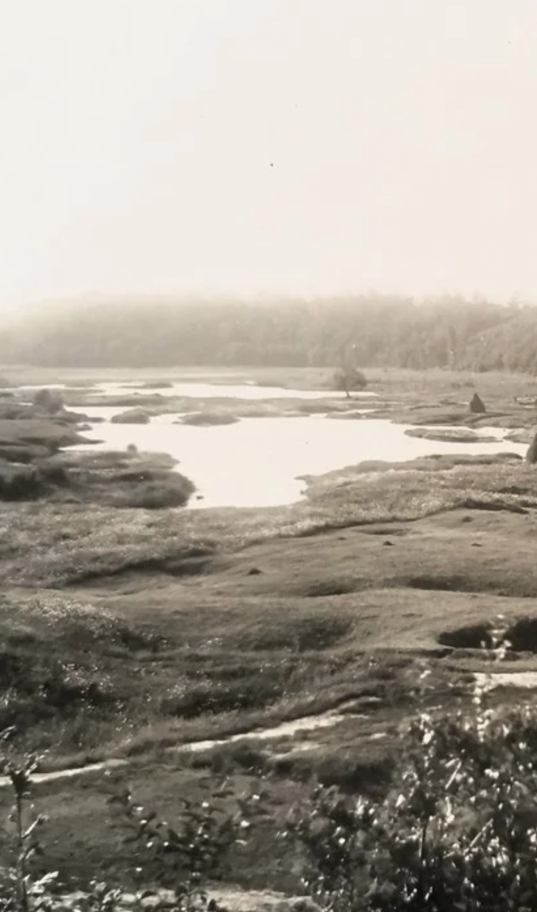
Salt Lake – Hydrological Natural Monument. Village of Danylovo.
On the outskirts of Danylovo village lies a hydrological natural monument of local significance in Ukraine – the Salt Lake (Ozero Solone). The area spans 2.5 hectares and was granted status as an object of the natural reserve fund of the Zakarpattia region in 1969. This area is known as the Yamy Tract and is designated for the preservation of the salt lake, the waters of which are reputed to have healing properties. The lake itself covers a relatively small area – 2.5 hectares. The reservoir is situated on the edge of an oak grove. Local residents frequented this oak forest, collecting mushrooms and berries, picnicking on the lake's shore, and swimming in its waters.
Finding the lake isn't difficult. You need to drive to the end of Ukrainska Street. Its ancient name is Handal. The area itself is called the Yamy Tract (Yamy meaning ‘Pits’ or ‘Holes’) for a reason. There are quite a few pits and depressions around here because, in ancient times, an intensive process of salt extraction took place here. Legend has it that the village was also much larger than it is now. Some reservoirs and wells had water so salty (brine, or ropa) that salt could be extracted by boiling. Salt-making was also one of the ancient crafts of simple peasants.
Locals refer to the lake as Vyshnie Lake, meaning Upper Lake, as there were several of them. Some residents can still recall the name Serednie Lake (Middle Lake). The reservoirs likely formed due to anthropogenic factors and salt extraction. The sites where salt was mined became flooded with water, both from underground sources and from rain and meltwater. Therefore, the formation and disappearance of smaller lakes are scientifically understandable.
Danylovo village, Khust District.
In the village of Danylovo, on the banks of the Baylova River, there is a health and spa complex. The water supplied to the complex is mineral water with healing properties for various ailments. In addition to wellness procedures, visitors can enjoy other services. This is a modern health and spa complex, located on the site of a deposit of unique hydrogen sulphide mineral water. Waters of this type have been used for therapeutic purposes since ancient times, particularly for the rehabilitation of the musculoskeletal system.
The complex includes a bathhouse and tubs (chany), which are filled with this mineral water. The healing properties of the local mineral water are widely recognised. Of course, such treatment should be approached individually, with consultation from specialists. But for a simple visit and relaxation, it is worth immersing yourself in a bath or tub at the end of an excursion day.
Oleksandrivka village – well with salt water.
On the way from Danylovo to Oleksandrivka village, we'll stop to visit the "brine" (rop'yanyy) well in the village. The history of this village is connected with brine (ropa) – very salty water from a unique well, which in the early 20th century brought the village fame and significant income. The water in this well is so salty that up to 1 kg of salt can be boiled out of 7 litres of water. Locals once engaged in salt-making. Today, few people practise this craft, though some still use the brine for salting pork fat (salo) and vegetables.
It is a shame that this well is in such a poor state. In ancient times, the process of boiling down salt was very widespread. The brine was scooped out of the well and boiled in cauldrons over a fire for several days, leaving the salt behind. After such evaporation, the salt was sold, which was the main source of income in the past. To scoop brine from the well, people had to queue, sometimes for several days. Nowadays, salt is no longer evaporated from the well in Oleksandrivka.
In ancient times, the village's name was Shandrovo. This name and pronunciation still persist among the people today. Until recently, the salty water from the well was used to prepare food for cattle. Currently, unfortunately, the unique well may disappear as it is no longer maintained. It is a pity that residents of 99 villages in Maramureș once relied on the Shandrovo well, and now it has fallen into neglect.
Солоне озеро, с. Олександрівка
Also noteworthy in Oleksandrivka village on Myru Street, in the Herts Tract, is a salt lake, which is a hydrological natural monument of local significance in Ukraine and an object of the regional nature protection fund. The lake is located at the foot of a small mountain with an area of slightly less than 3 hectares, with salty water that has healing properties. Most likely, the lake arose as a result of salt mining in the past. In this area, rock salt deposits lie relatively close to the surface. Since ancient times, salt was extracted here using the open-pit method. Over time, such places and pits were flooded with water, and salty reservoirs – lakes and wells – were formed. It was precisely this kind of water that was used to season local dishes.
Historical sources indicate that salt was mined in Oleksandrivka from 1743 to 1780. For some time, salt digging was abandoned, but extraction resumed later. In 1832, the mines were abandoned and flooded the following year. Most likely, the lake with salt water was formed then.
Wooden church of Saint Paraskeva, Oleksandrivka village.
In the village of Oleksandrivka, the wooden Church of St Paraskeva is the main attraction for tourists and scholars. However, as is the case with many wooden churches in Zakarpattia, it is in a poor state of repair. The situation is further complicated by the fact that the church is no longer in use. Nevertheless, the active churches in Krainykovo and Danylovo are better maintained than those in Oleksandrivka and Sokyrnytsia. Despite careful attention to the architectural, cultural and historical monument, there is also a religious and spiritual approach to preserving the sacred structures of our ancestors. Technical condition surveys of St. Paraskeva Church confirmed that the log cabins (zruby) of the church are in satisfactory condition; the shingle roofing of the church is partially damaged (10%-15%); the floor is missing, and the surface of the walls and the ceiling (“nebo”) with frescoes are covered with cobwebs and soiled. The murals, created by folk artists, also require restoration.
St. Paraskeva Church is the smallest among the wooden sacred structures of the Khust district, dating back to the 15th–18th centuries. The structure crowns the wide surface of the hill and is clearly silhouetted against the background of low mountains. The church is built from massive oak planks and stands on a stone foundation.
The bell tower next to St. Paraskeva Church is reminiscent of those in villages where wooden churches, built of oak and featuring tall Gothic spires, stand as masterpieces of folk architecture. Within them lies the spiritual world of our ancestors.
Vyshkovo Settlement
The history of Vyshkovo is linked to an ancient fortification, first mentioned in 1271, which controlled the salt route along the Tysa River. The settlement, located on the left bank of the Tysa River, was once one of the five free royal towns of Maramureș county and began to play a leading role in the territory in the 14th century. A castle was even built on the mountain that towered over the town. However, after Khust strengthened as a power centre, Vyshkovo gradually lost its significance. Hungarians have lived in Vyshkovo since ancient times, when the settlement was a town of importance and influence.
The settlement is spread over a large territory on the left bank of the Tysa River in the foothills of the Volcanic Carpathians. There are many fruit orchards in the vicinity of Vyshkovo. Vyshkovo was also famous for its crafts and masters, builders, carvers, etc. Adherents of all major Christian confessions live here. Ukrainians and Hungarians have lived here since ancient times. And there were once quite a few Swabians, Jews, Romanians, and other nationalities. Currently, the population is over 8,000 inhabitants. Vyshkovo is the main settlement in the historical area of Zatysianshchyna, in the Khust district, meaning the largest settlement on the left bank of the Tysa River. All surrounding villages were always considered hamlets (prysilky) of Vyshkovo – the villages of Yablunivka, Rakosh, Modiorysh, and Shayane, which this audio guide will introduce you to. And since 2020, Velyatyno village also belongs to the Vyshkovo amalgamated territorial community (OTG).
The oldest structure in Vyshkovo is the church, which stands on a small hill in the northern part of the current settlement and has largely retained its medieval appearance. Its walls are constructed from rough stone, and the decorative elements are fashioned from hewn stone. To the rectangular nave, which has a flat ceiling, an elongated apse is attached on the eastern side, ending in five facets of an octagon.
The first mention of the church dates back to the end of the 13th century. In terms of its size, the Vyshkovo church is the largest among the temples of those settlements that received the status of free royal towns in 1329. Also characteristic of those times is the ornamental decoration with a plant motif on the pillars of the altar completion. The artistic and architectural value of the church building increased thanks to the sensational find of József Lángi, who discovered fragments of frescoes during research in November 2012. The apse walls are covered with fresco compositions executed in excellent technique on the themes of “The Last Supper,” “The Betrayal of the Saviour in the Garden of Gethsemane,” and “Holy Martyrs.” The continuation of research and restoration work may contribute to the transformation of the Vyshkovo Reformed Church into one of the most attractive objects of religious tourism. The territory around the church was already enclosed by a stone defensive wall in the Middle Ages. In addition to its religious needs, this stone complex performed a defensive and protective function for the inhabitants of the small town. In 1717, the residents of Vyshkovo defended themselves in this temple from the Tatar invasion. Unable to withstand the siege, the residents were killed, and the church was burned by the Tatars. After several decades, the roof and the internal interior of the temple were restored. The date 1789 is on the ceiling (plafon) – the restoration of the temple. In the early 19th century, a framed wooden bell tower appeared next to the temple. A luxurious arboretum spread around it with dozens of species of trees and bushes, with rose alleys along the southern wall of the temple, on which there is a sundial.
Craft Beer – Vyshkovo
Driving from the 13th–14th century Vyshkovo church on the way to Shayane village, one can try Kibler craft beer, brewed at the local brewery. There are various facilities on the complex’s territory, including a brewery, a pizzeria, a spa complex, a sports complex with tennis courts, and a wine cellar. An incredible view of the Volcanic Ridge of the Hutynskyi Massif opens up from the complex. The Ukrainian-Romanian border runs along the crest of the mountain ridge. The mountains are covered with beech forests, while the foothills and bases of the mountains are covered with oak-hornbeam stands. Apple orchards are abundant in the area, and Vyshkovo was once famous for its orchards.
Shayane village, Vyshkovo territorial community.
Shayane is a small village, 7 km from ancient Vyshkovo, renowned throughout Ukraine and beyond for its mineral, healing waters. Nowadays, Shayane water is even more potent and therapeutic. There are also two other deposits, whose mineral waters are bottled by several enterprises. One can taste the mineral waters in the central pump room of the resort village. During a long stay and spa treatment, the water can also be consumed for therapeutic and health purposes. Shayane water has a wide range of healing properties, including normalising stomach acidity, having an anti-inflammatory effect on the digestive organs, stimulating bile formation, and improving the outflow of pancreatic juice. It is therapeutic for diabetes and has a diuretic effect due to the content of silicon and magnesium. The mineral composition includes bicarbonates, sodium, magnesium, silicon, and other minerals that regulate metabolism. It helps reduce cholesterol levels and improves blood circulation. It boosts immunity and improves skin condition. It relieves the negative effects of stress on the body and has a soft and pleasant taste. The first written mentions of Shayane waters appeared in 1753. By 1818, the first sanatorium – Zamkova Kupil (Castle Bath) – was opened, though it was in Vyshkovo at the foot of Varhed Mountain. This mineral water is one of the best in Ukraine and Europe.
Shayane nestles within a family of mountains, including Mount Shayane, Shayanyatko, and Mount Shayanykha. The Kibler River meanders through the entire village before flowing into the Tysa River outside the village of Shayane. The resort village boasts several sanatoriums and rehabilitation centres, approximately 20 hotels and estates, as well as numerous restaurants, cafes, and other tourist attractions. It is a very cosy and tranquil place. The curative mineral water and air, combined with the forests and mountains, create an incredible atmosphere. For many citizens of Ukraine, the village of Shayane has become a beloved holiday destination. They visit every year, with some even returning several times throughout the year during different seasons.
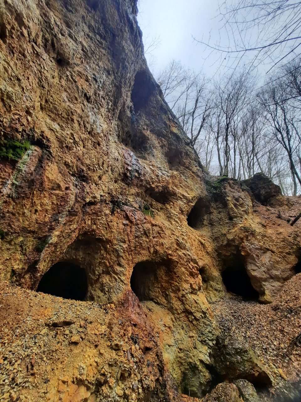
Abandoned adits (stolnias), Shayane village.
Near the pump room, consulting the map on the information stand, which details hiking trails in the low Shayane mountains and forest, you can discover a little-known geological feature – abandoned adits (shafts). While venturing into the underground passages themselves is not advised, even viewing them from afar offers excellent opportunities for striking Instagram photographs. Adjacent to them, an information stand provides details about this local geological monument. The ore extraction process spanned only a few years but still left a notable impact. In some locations, nature has begun to reclaim the land, with the forest regrowing where rock was quarried using the open-pit method. The adits, when viewed from Mount Shayane, appear to survey the landscape, evoking images of Hephaestus, the ancient Greek and Roman god of blacksmithing. In recent years, this man-made structure has become increasingly popular with visitors and tourists alike. Numerous bloggers have documented their visits, promoting this spot that was previously known primarily to local residents. At first glance, they resemble enormous beehives, but in reality, they are adits. Climbing inside is extremely hazardous and should be strictly avoided. It is best to admire these geological formations from a safe distance.
Natural Shayane Forest and Mountain Route.
Continuing along the tourist routes, we immerse ourselves in the world of pristine nature. On the southeastern slopes of Mount Shayane and Mount Shayanykha, natural centuries-old oak forests have been preserved, while on other slopes, beech-hornbeam forests thrive. There are few places where such natural environments have been preserved at a relatively short distance from civilisation. These forests belong to natural forest stands and quasi-primeval forests. Tourists vacationing in Shayane can already explore marked routes. There are two tourist products – one circling Mount Shayane with an ascent to its peak, and the small scenic Shayane Ring. The lengths are 4 km and 4.5 km, both starting near the mineral water pump room. There is a map and basic information on the information stand, as well as QR codes that allow you to download the routes to your smartphone for a safe and convenient walk. Signs are installed along the way, everything is clearly marked, and during the walk, you can comfortably rest on “forest furniture,” next to which beautiful views open up. Since the slopes of the main and namesake Mount Shayane are quite steep, you can reach the top from the northwestern slope, where there is a path with a signpost. Mount Shayane has already become a magnet and talisman of Shayane village. Usually, one must walk kilometres, sometimes tens of kilometres, to reach a pristine corner of nature, but here, relatively close, you can climb these routes and see centuries-old oaks and beeches. Visitors can experience natural forest and quasi-primeval forest environments. Some vacationers traditionally climb to the top of the mountain every day during their stay.