
Regional tourist routes
"Transcarpathian tourist route"
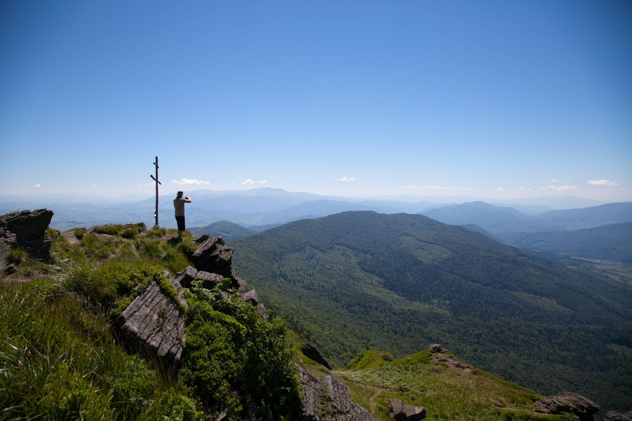
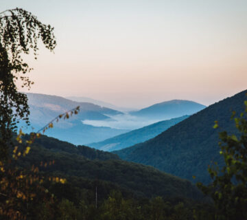
This is the longest marked hiking route in Ukraine, with a length of 398 km and a total elevation gain of 20 km, which runs through the Carpathian Mountains.
The route stretches from the village of Velykyi Bereznyi, which is located near the Ukrainian-Slovak border, to the village of Dilove, which is located near the Ukrainian-Romanian border.
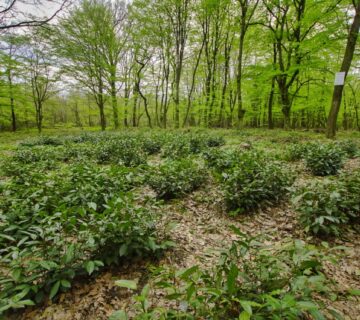
The Transcarpathian Tourist Trail (TT) runs along the main mountain ranges of the Ukrainian Carpathians: Borzhavsky, Vododilny, Svydovetsky and Chornohirsky; partially passes through the Gorgany and Beskydy.
The route passes through many villages and points: Velykyi Bereznyi (beginning) - Stuzhytsia - Uzhok pass - Bilasovytsia - Volovets - Mizhhiria - Kolochava - Ust-Chorna - Kvasy - Dilove (end), and several other villages along the route
The Velykyi Bereznyi - Dubovyi Hai section: The length is 14.6 km, the height difference is 741 m. The average duration of the journey is 5-8 hours. Marked in 2008-2009, updated in 2016. This section of the ZTSH starts from Velykyi Bereznyi, climbs the Yavirnyk ridge, enters the territory of Uzhanskyi NNP, and ends in the Dubovyi Hai tract. The marking is red.
The Uzhok - Volovets section: length - 61.5 km, elevation difference - 902 m (total elevation gain along the way - 2140 m, descent - 2500 m). The average duration of the journey is 23-32 hours. Marked in 2010-2011, updated in 2019. This section of the WTS starts from the Uzhok Pass, climbs the Verkhovyna Watershed Ridge, the highest point is Mount Pikuy, descends to the village of Bilasovytsia, and through the Serednyi Veretskyi Pass stretches to Volovets (railway station).
Mizhhirya-Kolochava section: length-38 km, elevation difference - 1244 m. The average duration of the journey is 10-20 hours. Marked in 2008-2009, updated in 2017. This section of the WTS starts from the village of Mizhhirya, climbs a picturesque ridge in the direction of the Synevyr Pass, enters the territory of the Synevyr National Park, crosses the village of Synevyr, passes through the Pishkonya ridge (the highest point of Negrovets is 1709 m), and ends in the village of Kolochava. The marking is red.
The Kolochava-Kvasy site (Krasna valley-Svydovets ridge): length - 36 km, average duration - 20-40 hours, updated markings in 2018. From Kolochava, the trail ascends to Mt. Krasnyi Verkh, stretches along the Krasna ridge through the mountains of Syhlyanskyi, Gropa, Klymova and gently descends to Ust-Chorna. From Ust-Chorna it rises to Mount Tempa and goes along the Svydovets and Apshynets ranges between high-mountain lakes, above the Dragobrat ski resort, the highest point of Mount Blyznytsia and smoothly descends through the Brailka meadow to the village of Kvasy. The marking is red.
Interesting to knowAlina Kosovska, a tourist from Avdiivka, walked the Transcarpathian tourist route on her own in 37 days. The journey lasted from 8 January to 14 February 2022.
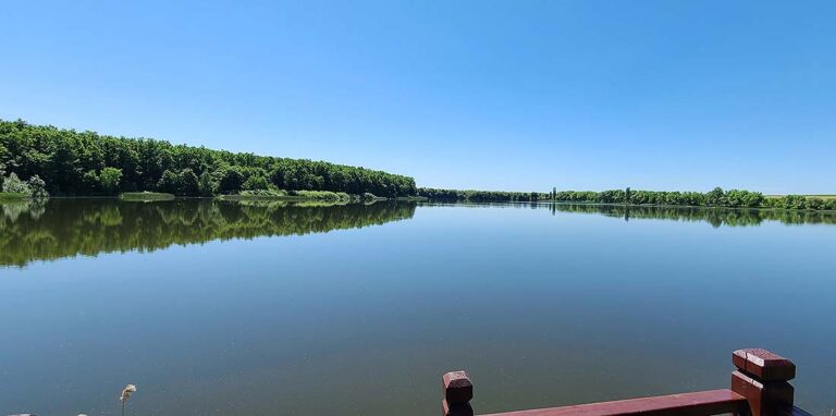
"7 Lakes
The length is 63 km, the height difference is 65 m. The route is designed for 2 days.
The route passes through 8 settlements of the Mukachevo and Velykyi Bereznyi territorial communities and along public roads of local and national importance: C070706 "Mukachevo-Makaryovo-Zaluzhzhia", C070735 "Makaryovo-Bereguifalu" and H-09 "Mukachevo-Rakhiv-Bohorodchany-Ivano-Frankivsk-Rohatyn-Bibrka-Lviv".
The bicycle route along the water bodies of the Transcarpathian lowland has two possible starting points: the village of Schönborn in Mukachevo TG or the village of Velyki Berehy in Berezny TG. The route is mostly flat and has two small ascents. The marking is green.
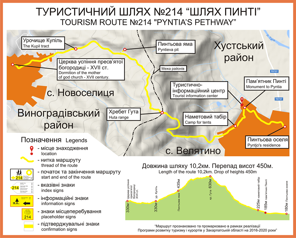
"Pinty's Way"
The length is 10.2 km, the height difference is 450 m. The average duration is 3 hours. The route was opened as part of the of the Walnut dishes festival in 2019 and it connects the villages of Novoselytsia in Vynohradiv district and the village of Velyatino in Khust district. Among the route's attractions are the famous stone of power, the beginning of the Botar River, the Lefantovo tract and the Pintova Pit. There are recreation areas and camping sites along the route.
The route starts and ends in the Tisa river valley, but passes through the Huta volcanic range. Most of it runs through beech forests. It connects two settlements (Novoselytsia and Velyatino). The following sightseeing sites can be visited along the route: The Church of the Assumption of the Blessed Virgin Mary of the 17th century; the Kupil tract; the rock of the sentinel Pinto; Pinto's Pit; the Pinto monument; the Pinto spring and the Pinto's House historical and local history museum.
On both sides of the route, there is a possibility to set up tent camps and resting places in the Kupil and Velyatino villages. You can visit catering establishments and receive medical care in the villages of Novoselytsia and Velyatino. In the village of Velyatyno, you can also visit the Tepli Vody recreation complex, which houses a tourist information centre. Mobile communication is available along the entire route.
Interesting to know: Hryhoriy Pintya was a legendary opryshok who fought against Austrian rule. Stories are told about him and he is called the Ukrainian Robin Hood.
No comment