
The highest peaks INkraїof the Carpathian Mountains
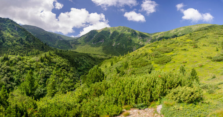
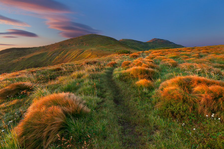
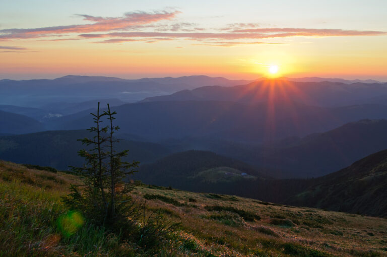
The Carpathian Mountains make Zakarpattia unique, attracting thousands of people with their beauty and majesty. Every day in the Carpathian Mountains is full of new experiences, especially for city dwellers who consider going outdoors a real event. Many of the Carpathian peaks are perfect for one- or two-day climbs. And for those who love mountain nature, the Carpathians are the best choice for a holiday. In spring, saffron and rhododendron bloom profusely here, in summer the slopes are covered with bright greenery, and in autumn - a golden carpet. So we invite you to the wonderful world of the Ukrainian Carpathians. Our list opens with the highest peak...
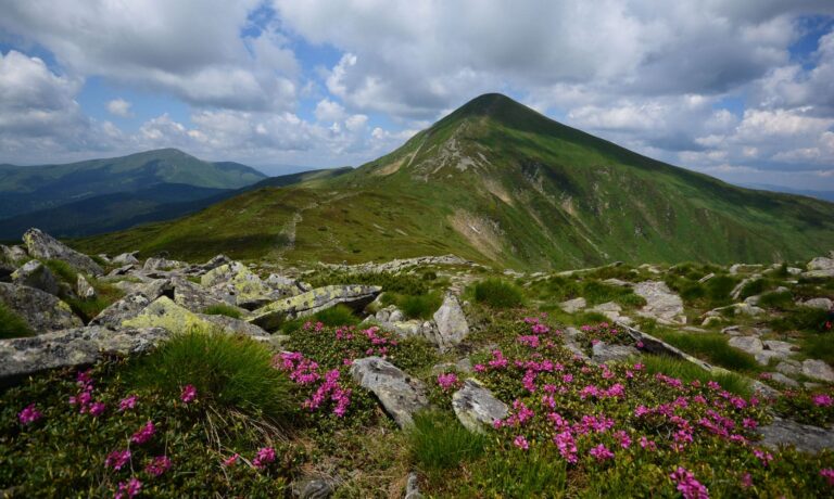
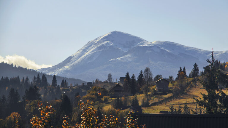
Mount Hoverla is the highest point not only in the Ukrainian Carpathians but also in Ukraine. The peak is located in the Chornohora mountain range, most of which is part of the Carpathian Biosphere Reserve and the Carpathian National Nature Park. Hoverla is located on the border of Rakhiv district of Zakarpattia region and Nadvirna district of Ivano-Frankivsk region, 17 km from the Romanian border.
Shrouded in numerous legends and tales, this peak is one of the favourite among those who hike the Montenegrin ridge.
It is the most famous mountain in the country. Many Ukrainians begin their acquaintance with the Carpathian Mountains with Hoverla. The name of the mountain, according to legend, means "snow-capped peak" or "rugged hill". Hoverla is shaped like a regular cone. It is covered with shrubs, alpine meadows, and at the top - mostly with stone placers and boulders. A small flat platform on the top of Hoverla offers majestic views of the Montenegrin ridge.
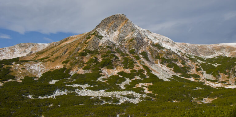
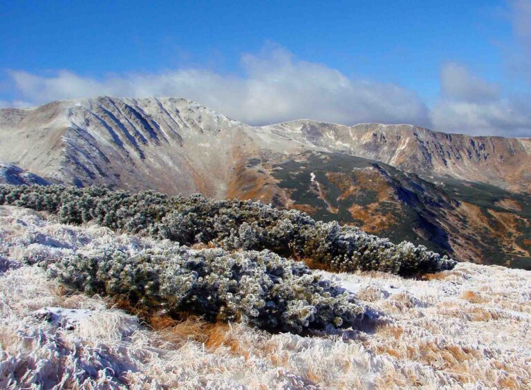
Mount Brebeneskul is the second highest peak in Ukraine, which is also part of the Montenegrin mountain range. This domed mountain is located on the border of Ivano-Frankivsk and Zakarpattia regions. Brebeneskul has ancient ice reliefs and traces of frosty weathering. Its silvery snowy garments can be seen even in summer.
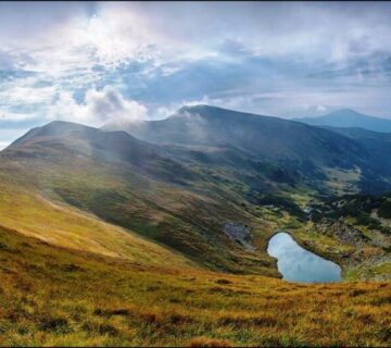
On the slope of Mount Brebeneskul, you can see the most picturesque lake in our country, also called Brebeneskul (1801 m). It is an exquisite work of nature and is considered a hydrological monument.
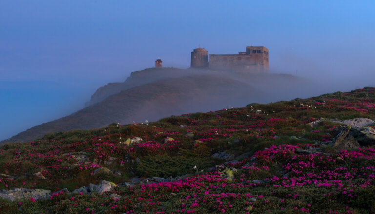
The name of the mountain comes from a rock on its top that resembled a priest in a cassock. Unfortunately, this rock is now gone, so it is not possible to verify this. The summit offers an extraordinary panoramic view of the entire Montenegrin ridge. Not far from the summit is the building of the meteorological and astronomical observatory, which was built by the Poles back in 1938. Today, these remains are a tourist attraction called the White Elephant.
Pip Ivan becomes especially picturesque in winter, when snow covers the observatory. It is worth noting that the White Elephant Observatory is the tallest building in Ukraine, where people used to live and work.
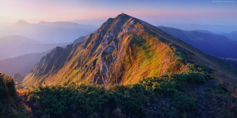
This mountain has steep rocky slopes. The western and south-western slopes have numerous scattered stones, while the northern and northeastern slopes are steep and have rocky outcrops. Petros is often called a stormy peak: in bad weather, lightning often strikes here and harsh winds blow. The mountain is often shrouded in clouds, and the stormy wind twists the metal protective fences. The path here is difficult, but the views from the top are magical: Hoverla and Pip Ivan are visible from here.
Petros is connected to the main peak of the Ukrainian Carpathians by a bridge - the saddle. After crossing it, you will find a cosy foresters' house where you can relax and gain strength before storming Hoverla. As a rule, climbing Petros starts from the villages of Kvasy and Lazeshchyna in Rakhiv district.
When listing the most picturesque peaks of the Carpathians, it is worth mentioning Hutyn Tomnatyk, which is only slightly lower than Mount Petros and is also located on the Chornohora ridge. On the northeastern slope, between Hutyn Tomnatyk and Mount Brebeneskul, at an altitude of 1801 metres above sea level, there is Lake Brebeneskul, the highest mountainous lake in Ukraine. There are many rare relict plant species here, and the weather is more favourable than on Mount Petros.
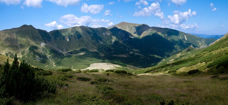
This mountain is located in the central part of the Montenegrin ridge, with the mountains Turkul, Brebeneskul and Gutyn Tomnatyk surrounding it. There are several small alpine lakes to the west of the peak. The Ribs look especially impressive in summer: the slopes, covered with a carpet of green grasses, are cut by sharp rocky protrusions resembling ribs. Here you can see the remains of ancient fortifications, including trenches and marked posts. The Ribs were once the Polish-Czechoslovakian border. There are five hiking routes to the top, so you can choose the most convenient one for yourself.
This peak lacked very little to become one of the two thousandth peaks. It is located between the Brebeneskul and Dzembronia mountains and is part of the Montenegrin ridge. The name Menchul comes from Romanian (munteul) and means "mountain". The slopes of Menchul are gentle. The Rozshybenyk mountain range begins from Menchul. You can get to this region by following the route from the village of Hoverla. There is also a trail that runs through Mount Brebeneskul.
Mount Pip Ivan of Marmarosh is the highest peak of the Marmarosh massif (Maramarosh). The Marmarosh or Rakhiv Mountains are one of the most picturesque and inaccessible mountain ranges in the Carpathians, with a typical alpine relief. Powerful rocky outcrops, numerous cliffs, significant elevation differences, sharp steep peaks, deep valleys, dense primeval forests, flowering meadows, clear streams, and alpine lakes make the Ukrainian Marmaros and the European Alps look like each other. This mountain range divides Ukraine and Romania and forms the border between these countries. Many tourists dream of visiting the Marmaros and conquering the Pip Ivan Marmarosky peak. It is a bit difficult and far to get there. But it is quite possible!
The mountain with a triangular peak and step-like slopes is located on the Montenegrin ridge. The mountain's name may have been derived from the ancient Carpathian name for a snow bull. It is located on the border of Zakarpattia and Ivano-Frankivsk regions. From the top of the mountain, you can enjoy an amazing view of the Montenegrin ridge. Turkul is a popular tourist destination: it is home to a freshwater body of water - Lake Nesamovyte, one of the most famous Carpathian lakes, near which almost all hiking routes along the Montenegrin range pass.
Mount Breskul is the closest neighbour of the highest peak in the country and is located between Hoverla and Pozhyzhevska. Breskul has a dome shape, which is probably why it got its name: from the Hutsul dialect "bretskul" - "swollen", "bulging". It is useful to know that there is a lake of the same name, Breskul, near the top.

It is the highest point of the Svydovets massif. This mountain is known together with its "sister", Mount Bliznytsia, with a peak of 1872 metres above sea level. They stand side by side and look the same. Many popular tourist routes pass through them.
The publication uses photographs by Mykhailo Markovych, Ruslan Romaniuk, Yaroslav Turkmenko, Stanislav Pikun, Yevhen Novosad, Andriy Mayovskyi, and Oleksandr Kotenko.

No comment